Approximate Location Map
Large Map »
Latitude: 52.7053 / 52°42'19"N
Longitude: -2.7533 / 2°45'11"W
OS Eastings: 349199
OS Northings: 312226
OS Grid: SJ491122
Mapcode National: GBR BJ.2NVM
Mapcode Global: WH8BT.P83C
Plus Code: 9C4VP64W+4M
Entry Name: Town Walls
Listing Date: 10 January 1995
Grade: II*
Source: Historic England
Source ID: 1254934
English Heritage Legacy ID: 458385
ID on this website: 101254934
Location: Shrewsbury, Shropshire, SY1
County: Shropshire
Civil Parish: Shrewsbury
Built-Up Area: Shrewsbury
Traditional County: Shropshire
Lieutenancy Area (Ceremonial County): Shropshire
Church of England Parish: Shrewsbury St Chad
Church of England Diocese: Lichfield
Tagged with: City walls
SJ4912SW
653-1/15/684
10/01/53
SHREWSBURY
TOWN WALLS
(South side)
Town Walls
GV
II*
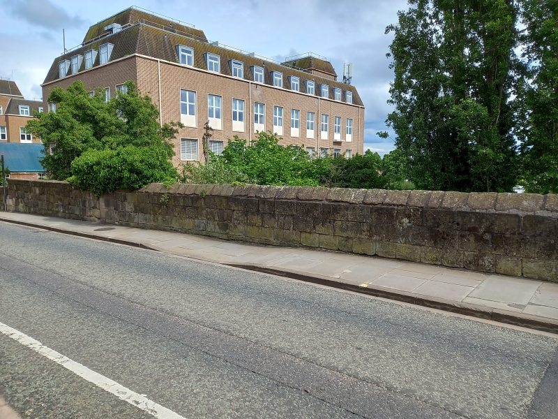
Town walls. C13. Coursed and squared sandstone. Largely a
retaining wall, but terminating as parapet with raking coping.
Incorporates plaque inscribed "This part of ye wall was
repaired A.D. 1740. Edward Twiss esq. mayor. Mr Samuel Elisha
and Mr Arthur Downes, Coroners".
Listing NGR: SJ4919912226
External links are from the relevant listing authority and, where applicable, Wikidata. Wikidata IDs may be related buildings as well as this specific building. If you want to add or update a link, you will need to do so by editing the Wikidata entry.


Other nearby listed buildings
