Approximate Location Map
Large Map »
Latitude: 52.2274 / 52°13'38"N
Longitude: -2.7386 / 2°44'19"W
OS Eastings: 349644
OS Northings: 259054
OS Grid: SO496590
Mapcode National: GBR FK.1THP
Mapcode Global: VH84W.H81T
Plus Code: 9C4V67G6+XG
Entry Name: 23, 23A and 23B, High Street
Listing Date: 9 July 1976
Last Amended: 3 October 2023
Grade: II
Source: Historic England
Source ID: 1255469
English Heritage Legacy ID: 459740
ID on this website: 101255469
Location: Leominster, County of Herefordshire, HR6
County: County of Herefordshire
Civil Parish: Leominster
Built-Up Area: Leominster
Traditional County: Herefordshire
Lieutenancy Area (Ceremonial County): Herefordshire
Church of England Parish: Leominster
Church of England Diocese: Hereford
Tagged with: Building
Shop and dwelling constructed in the late-C18 or early-C19. The shopfront was replaced during the mid-C20. It is now (2022) in use as a shop with flats above.
Shop and dwelling constructed in the late-C18 or early-C19. The shopfront was replaced during the mid-C20. It is now (2022) in use as a shop with flats above.
MATERIALS: the building is constructed of red brick laid in Flemish bond with stucco dressings and a timber shopfront and eaves. The partially-exposed rear elevation is of roughcast render. The roof covering is understood to be slate.
PLAN: the building is arranged on a rectangular plan facing the High Street to the west and enclosed on three sides by adjoining buildings. There is access to the rear via an alleyway off of Victoria Street to the south and a doorway in the partially-exposed south elevation.
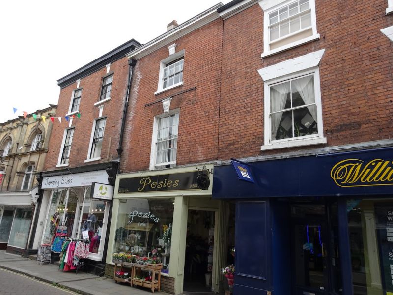
EXTERIOR: the building is three storeys in height under a pitched roof with a moulded timber cornice. The principal elevation onto High Street (to the west) is one bay wide. On the ground floor is a timber shopfront with a brick base, consisting of two pilasters framing a large, plate glass window, with an entrance containing a modern (late-C20) door from Ironmongers Lane, within a moulded, C19 doorframe with blocked overlight, and a large fascia board with a moulded border.
The first and second floors each carry a single, timber sash window with gauged brickwork flat-arch heads with enriched stucco keystones. The first-floor window has eight-over-eight glazing and the second-floor window has four-over-eight glazing, along with a stucco sill. Between the first and second-floor windows is a long, horizontal iron strap with forked ends.
The partially-exposed south elevation has timber, C20 door on the ground floor. The upper floors are jettied. The first and second floors each carry a two-over-two glazed, timber sash window with horns, set within a plain timber surround set flush with the façade.
The town of Leominster traces its origins to the establishment of a religious house there during the C7 or earlier. The Saxon settlement endured repeated Viking raids and is recorded as a sizeable town in the Domesday Book (1086), with 27 households. In the early-C12, King Henry I established a Benedictine Priory in the town and granted a foundation charter for the town’s market. The town thrived throughout the later medieval period, despite periodic unrest due to its location in the border region. Leominster wool was prized across Europe and bestowed considerable wealth upon the town. The town centre retains many medieval and early-modern buildings; secular buildings are timber framed while surviving Priory buildings are constructed of local sandstone. The town centre retains an essentially medieval street pattern, with long, narrow burgage plots fronting the north-south spine road of Broad Street-High Street-South Street, and Corn Square (the historic market place) lying to the east of the High Street. The remains of the Priory, dissolved in 1539, lie to the north-east of the town centre. The town remained a prominent local centre into the C18 and C19. During this period, many timber-framed buildings were replaced (or refronted) by brick buildings with Classical elevations. Many houses in the town centre were partially converted to commercial use and equipped with shopfronts during the later-C19 and C20.
The building was constructed during the late-C18 or early-C19, likely on the site of an earlier building. It was probably built as a shop house (a shop with dwelling above). A new shopfront was installed during the mid-C20. The building is currently (2022) in use as a shop with flats above.
External links are from the relevant listing authority and, where applicable, Wikidata. Wikidata IDs may be related buildings as well as this specific building. If you want to add or update a link, you will need to do so by editing the Wikidata entry.


Other nearby listed buildings
