Approximate Location Map
Large Map »
Latitude: 51.4392 / 51°26'21"N
Longitude: 0.7625 / 0°45'44"E
OS Eastings: 592091
OS Northings: 174751
OS Grid: TQ920747
Mapcode National: GBR RS2.MMD
Mapcode Global: VHKJ7.53G1
Plus Code: 9F32CQQ6+MX
Entry Name: 95, High Street
Listing Date: 30 June 1978
Grade: II
Source: Historic England
Source ID: 1258226
English Heritage Legacy ID: 444611
ID on this website: 101258226
Location: Sheerness, Swale, Kent, ME12
County: Kent
District: Swale
Electoral Ward/Division: Sheerness
Parish: Sheerness
Built-Up Area: Sheerness
Traditional County: Kent
Lieutenancy Area (Ceremonial County): Kent
Tagged with: Building
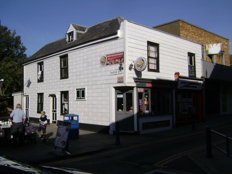
HIGH STREET
1.
5282
(West Side)
Mile Town, Sheerness
No 95
TQ 9274 NW 9/28
II
2.
C18. 2 storeys wood stuccoed and grooved in invitation of masonry. Hipped
slate roof. Parapet. 2 sashes. Later shopfront. The Wood Street elevation
has a slate roof with 1 hipped dormer. 2 sashes without glazing bars and 2
doorcases, 1 with wooden cornice and brackets.
Listing NGR: TQ9209174751
External links are from the relevant listing authority and, where applicable, Wikidata. Wikidata IDs may be related buildings as well as this specific building. If you want to add or update a link, you will need to do so by editing the Wikidata entry.


Other nearby listed buildings
