Latitude: 52.6495 / 52°38'58"N
Longitude: -2.4704 / 2°28'13"W
OS Eastings: 368274
OS Northings: 305850
OS Grid: SJ682058
Mapcode National: GBR BX.60KC
Mapcode Global: WH9D9.0NXQ
Plus Code: 9C4VJGXH+QV
Entry Name: Former Canal Bridge About 130 Metres South of Methodist Chapel
Listing Date: 9 December 1991
Grade: II
Source: Historic England
Source ID: 1258461
English Heritage Legacy ID: 445013
ID on this website: 101258461
Location: Little Dawley, Telford and Wrekin, Shropshire, TF4
County: Telford and Wrekin
Civil Parish: Dawley Hamlets
Built-Up Area: Telford
Traditional County: Shropshire
Lieutenancy Area (Ceremonial County): Shropshire
Church of England Parish: Central Telford
Church of England Diocese: Lichfield
Tagged with: Bridge
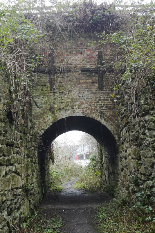
DAWLEY HAMLETS LIGHTMOOR ROAD SJ 60 NE Former canal bridge 31/10002 about 130 metres south of Methodist Chapel II Canal bridge. Circa 1790 to early C19. Stretcher bond red brick round arch on dressed sandstone plinth forming a barrel vaulted tunnel, about 5 metres long, through bank of spoil. Stone rubble and slag abutments at either end. The bridge now has a footpath above, but may have originally carried a colliery plateway over the line of the Shropshire Union Canal (completed in circa 1790). The 1882 OS map indicates that the canal was replaced by a small mineral line. The bridge probably connected Dawley Parva Colliery to Lightmoor Iron, Brick and Tile Works. Sources: Ironbridge Gorge Museum Trust; 1840 Tithe Map and 1882 OS Map.
Listing NGR: SJ6827405850
External links are from the relevant listing authority and, where applicable, Wikidata. Wikidata IDs may be related buildings as well as this specific building. If you want to add or update a link, you will need to do so by editing the Wikidata entry.


Other nearby listed buildings