Latitude: 53.9574 / 53°57'26"N
Longitude: -1.0838 / 1°5'1"W
OS Eastings: 460217
OS Northings: 451648
OS Grid: SE602516
Mapcode National: GBR NQWP.53
Mapcode Global: WHFC3.BS5J
Plus Code: 9C5WXW48+XF
Entry Name: Ouse Bridge and Attached Flights of Steps
Listing Date: 14 June 1954
Last Amended: 14 March 1997
Grade: II
Source: Historic England
Source ID: 1259354
English Heritage Legacy ID: 462986
ID on this website: 101259354
Location: York, North Yorkshire, YO1
County: York
Electoral Ward/Division: Micklegate
Parish: Non Civil Parish
Built-Up Area: York
Traditional County: Yorkshire
Lieutenancy Area (Ceremonial County): North Yorkshire
Church of England Parish: York All Saints, Pavement
Church of England Diocese: York
Tagged with: Bridge Road bridge
YORK
SE6051NW BRIDGE STREET 1112-1/28/10 Ouse Bridge and attached flights of 14/06/54 steps (Formerly Listed as: Ouse Bridge)
GV II
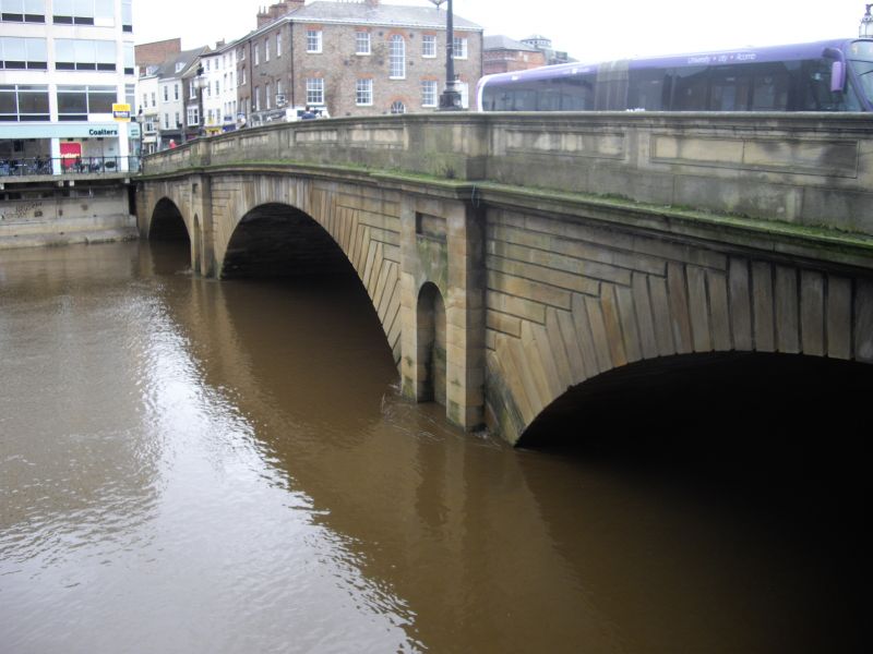
Bridge with flights of steps attached at each end on downstream side. 1810-20, with early C20 lamp standards. By Peter Atkinson junior. Limestone ashlar, rusticated; painted cast-iron lamp standards. 3-span bridge, with segmental arches of rusticated voussoirs between piers containing round-headed niches on half-octagonal cutwaters. Moulded cornice beneath sunk-panelled parapet with cambered coping. Piers rise into parapet to form plinths for fluted tapering lamp standards, branching at top for pendant lanterns, and with stylised flame finial. Similar flights of steps on east and west banks are straight with plain parapets, moulded cambered coping and cylindrical terminal piers with moulded flat caps. HISTORICAL NOTE: when the bridge foundation stone was laid a brass plate was set in a cavity, inscribed:- "The First Stone of This Bridge was laid December 10th in the Year MDCCCX and in the reign of George the Third by the Rt. Hon. Geo. Peacock Lord Mayor. Peter Atkinson Architect". (City of York: South-west of the Ouse: HMSO: 1972-: 48-50).
Listing NGR: SE6021751648
External links are from the relevant listing authority and, where applicable, Wikidata. Wikidata IDs may be related buildings as well as this specific building. If you want to add or update a link, you will need to do so by editing the Wikidata entry.


Other nearby listed buildings