Latitude: 53.1627 / 53°9'45"N
Longitude: -1.4799 / 1°28'47"W
OS Eastings: 434869
OS Northings: 362968
OS Grid: SK348629
Mapcode National: GBR 69Y.QNK
Mapcode Global: WHDFN.7RJS
Plus Code: 9C5W5G7C+32
Entry Name: Redfern House
Listing Date: 31 January 1967
Grade: II
Source: Historic England
Source ID: 1260325
English Heritage Legacy ID: 393469
ID on this website: 101260325
Location: Ashover, North East Derbyshire, S45
County: Derbyshire
District: North East Derbyshire
Civil Parish: Ashover
Built-Up Area: Ashover
Traditional County: Derbyshire
Lieutenancy Area (Ceremonial County): Derbyshire
Church of England Parish: Ashover All Saints
Church of England Diocese: Derby
Tagged with: House
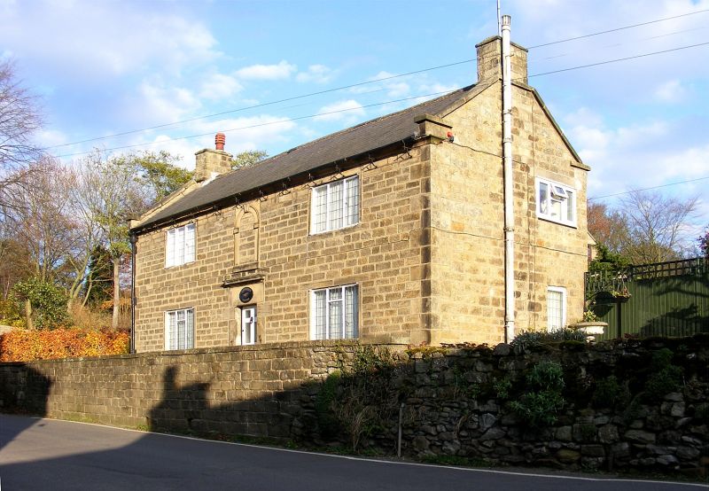
ASHOVER HOCKLEY LANE SK3462 1264-0/12/60 (East side) 31/01/67 Redfern House II House. Late C18, with C20 alterations and additions. Regularly coursed squared gritstone with ashlar dressings, quoins, coped gables with plain kneelers, ashlar gable stacks, and a Welsh slated roof. T-plan house. East elevation of 2 storeys and 2 bays, with a central doorway within a massive stone surround and with a deep lintel, incised with a margin for an inscription at the centre, but without lettering or numbers. Above the lintel, a cornice mould, and at first-floor level, a blind semicircular headed opening with flush frame, having imposts and an advanced keyblock. Flanking the doorway are stacked 3-light metal casements, set within the flush surrounds of former 2-light flush mullioned windows. Coved eaves band is returned at the ends. Lower gabled range to centre of main range at the rear. A single flush-mullioned opening at first floor level.
Listing NGR: SK3486962967
External links are from the relevant listing authority and, where applicable, Wikidata. Wikidata IDs may be related buildings as well as this specific building. If you want to add or update a link, you will need to do so by editing the Wikidata entry.


Other nearby listed buildings