Latitude: 53.1629 / 53°9'46"N
Longitude: -1.4805 / 1°28'49"W
OS Eastings: 434827
OS Northings: 362991
OS Grid: SK348629
Mapcode National: GBR 69Y.QJ2
Mapcode Global: WHDFN.7R7M
Plus Code: 9C5W5G79+5Q
Entry Name: The Old Bank House and Attached Boundary Wall
Listing Date: 31 January 1967
Last Amended: 30 August 1995
Grade: II
Source: Historic England
Source ID: 1260925
English Heritage Legacy ID: 393428
ID on this website: 101260925
Location: Ashover, North East Derbyshire, S45
County: Derbyshire
District: North East Derbyshire
Civil Parish: Ashover
Built-Up Area: Ashover
Traditional County: Derbyshire
Lieutenancy Area (Ceremonial County): Derbyshire
Church of England Parish: Ashover All Saints
Church of England Diocese: Derby
Tagged with: Bank building
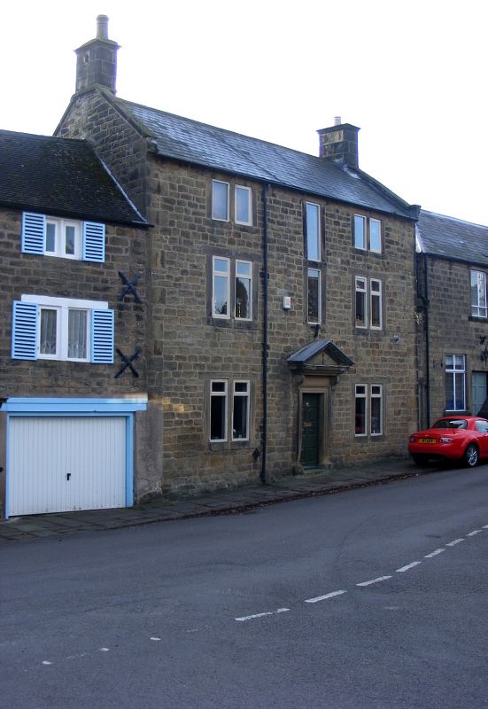
ASHOVER SK3462 BUTTS ROAD 1264-0/12/19 (South side) 31/01/67 The Old Bank House and attached boundary wall (Formerly Listed as: BUTTS ROAD Old Bank House) GV II House. Mid C18, with C20 alterations. Coursed squared gritstone with ashlar dressings, quoins, coped gables with moulded kneelers, gable stacks with moulded caps, and a Welsh slated roof. North elevation of 3 storeys and 3 bays, with a central doorway flanked by 2-light flush-mullioned windows, the second floor windows shallower than those on the ground and first floors. C20 casements, those to lower floors with top-hung transom lights. Doorway with architrave surround and with a pediment carried on console brackets. 8-panelled door with raised and fielded panels. Above the doorway, a 2-storey stair window with a flush surround. The house formerly had sash windows. Attached boundary wall, linking the building with the adjacent house, has a doorway with an architrave surround, and a C20 door.
Listing NGR: SK3482762991
External links are from the relevant listing authority and, where applicable, Wikidata. Wikidata IDs may be related buildings as well as this specific building. If you want to add or update a link, you will need to do so by editing the Wikidata entry.


Other nearby listed buildings