Latitude: 51.3913 / 51°23'28"N
Longitude: 1.38 / 1°22'48"E
OS Eastings: 635245
OS Northings: 171233
OS Grid: TR352712
Mapcode National: GBR WZS.MQN
Mapcode Global: VHLG6.V9X7
Plus Code: 9F3399RJ+G2
Entry Name: Stone Pier
Listing Date: 29 November 1989
Grade: II
Source: Historic England
Source ID: 1260334
English Heritage Legacy ID: 441070
ID on this website: 101260334
Location: Margate, Thanet, Kent, CT9
County: Kent
District: Thanet
Electoral Ward/Division: Margate Central
Parish: Non Civil Parish
Built-Up Area: Margate
Traditional County: Kent
Lieutenancy Area (Ceremonial County): Kent
Tagged with: Architectural structure
The following item shall be added to the list:-
TR 3571 MARGATE THE PARADE
2/277 Stone Pier
II
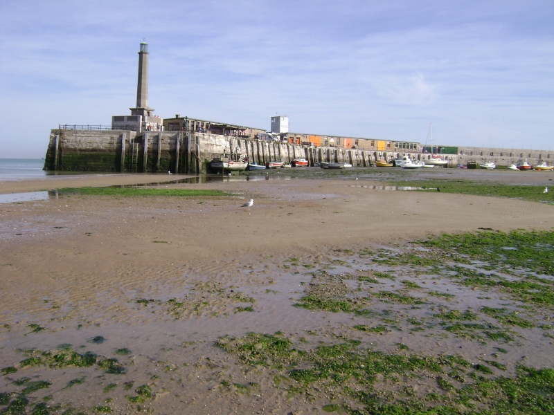
Pier. 1810-15. Designed by John Rennie. Stone and concrete. The pier consists of five sections, angled so as to form a westward curve enclosing the harbour. The basic structure is about 900 feet long, 60 feet wide and 26 feet high; a raised promenade runs from a point just above the Droit House as far as the lighthouse at the west end. The pier is built of roughly dressed stone and there are considerable remains of the cast iron balustrade in the second and third sections of the pier (numbering from the lighthouse; the remains of cast iron lamp standards at the beginning of the pier and along the promenade are more fragmentary. The original lighthouse was destroyed in 1953; the present lighthouse, in concrete, reproduce the general form but not the details of its predecessor. It was designed by W R H Gardner and built in 1854. Single-storey C20 workshops have been built on the fourth and fifth sections of the pier, backing up against the promenade.
Listing NGR: TR3524571233
External links are from the relevant listing authority and, where applicable, Wikidata. Wikidata IDs may be related buildings as well as this specific building. If you want to add or update a link, you will need to do so by editing the Wikidata entry.


Other nearby listed buildings