Latitude: 50.9462 / 50°56'46"N
Longitude: -2.7053 / 2°42'19"W
OS Eastings: 350546
OS Northings: 116548
OS Grid: ST505165
Mapcode National: GBR ML.NLFS
Mapcode Global: FRA 566L.ZVN
Plus Code: 9C2VW7WV+FV
Entry Name: Odcombe Gateway to Montacute Park, and Flanking Walling
Listing Date: 19 April 1961
Last Amended: 27 October 1987
Grade: II
Source: Historic England
Source ID: 1260493
English Heritage Legacy ID: 440364
ID on this website: 101260493
Location: Montacute, Somerset, BA22
County: Somerset
District: South Somerset
Civil Parish: Odcombe
Built-Up Area: Odcombe
Traditional County: Somerset
Lieutenancy Area (Ceremonial County): Somerset
Tagged with: Architectural structure
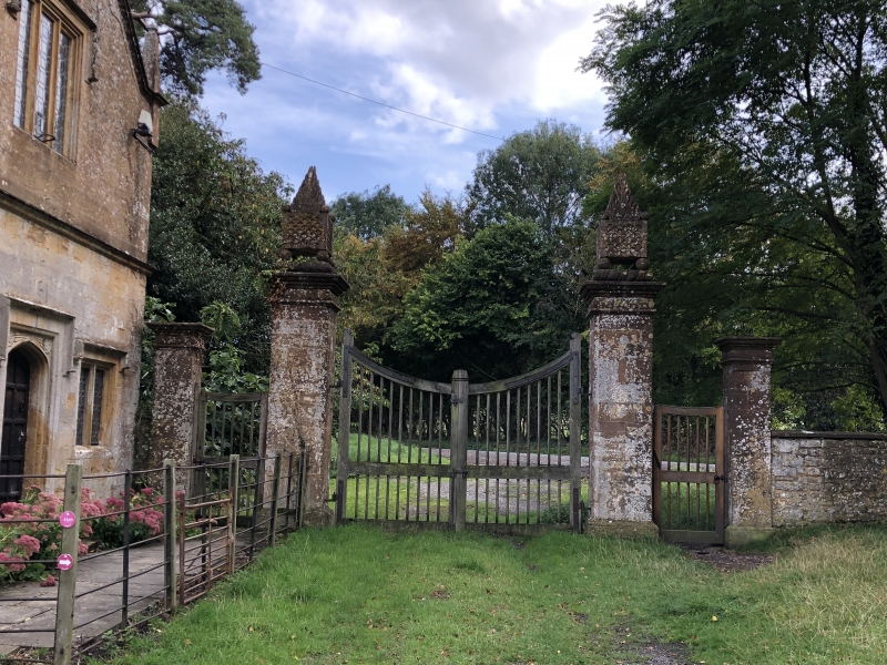
ST51NW ODCOMBE CP 3/236 Odcombe gateway to Montacute Park, and flanking walling (formerly listed as Gate Piers immediately south-west of New Lodge) 19.4.61 GV II Gateway with walling. Probably C19. Ham stone ashlar, with plain dressed copings about 1 metre high, with gateway marked by 4 square piers, the outer about 2.5 m tall and the inner about 3.5 m tall, having plinths, pulvinated frieze and cornice caps, the taller piers also with cabled step and fiery braziers in stone: between main piers a pair C20 timber gates, and to sides matching pedestrian gates: walling extends about 15 a westwards and about 70 m eastwards bath sections curved to fit the boundary of site. With the nearby New Lodge (qv), part of the important setting of Montacute House (qv).
Listing NGR: ST5056316531
External links are from the relevant listing authority and, where applicable, Wikidata. Wikidata IDs may be related buildings as well as this specific building. If you want to add or update a link, you will need to do so by editing the Wikidata entry.


Other nearby listed buildings