Latitude: 53.6991 / 53°41'56"N
Longitude: -1.4145 / 1°24'52"W
OS Eastings: 438753
OS Northings: 422678
OS Grid: SE387226
Mapcode National: GBR LTKN.KQ
Mapcode Global: WHDC5.79P1
Plus Code: 9C5WMHXP+J6
Entry Name: The Manor House
Listing Date: 9 October 1987
Grade: II
Source: Historic England
Source ID: 1261640
English Heritage Legacy ID: 437049
ID on this website: 101261640
Location: Normanton, Wakefield, West Yorkshire, WF6
County: Wakefield
Civil Parish: Normanton
Built-Up Area: Normanton
Traditional County: Yorkshire
Lieutenancy Area (Ceremonial County): West Yorkshire
Church of England Parish: Normanton All Saints
Church of England Diocese: Leeds
Tagged with: House
NORMANTON HIGH STREET SE 32 SE (east side) 2/53 No 129 (The Manor - House) - II
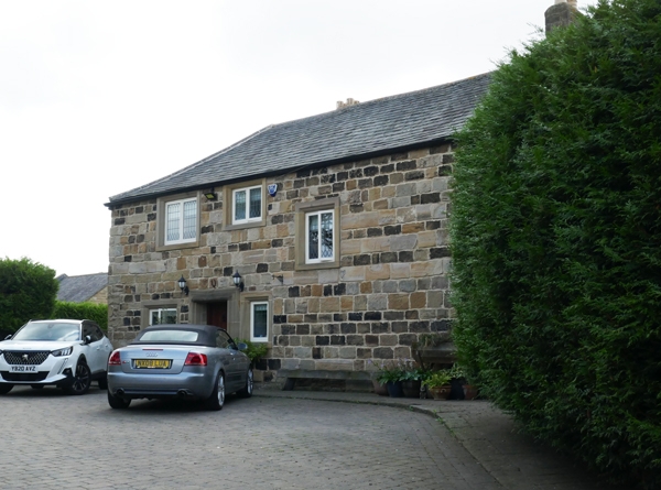
Farmhouse, now house Dated 1629 internally, altered. Coursed squared sandstone (mostly rendered), stone slate roof. L-plan, formed by 2-unit range on north-south axis with large one-unit wing in front of the lst, and with porch in angle. Two storeys; 2-storey gabled porch has a small window at ground floor (probably replacing former doorway), a 2-light double chamfered mullioned window above (and long lean-to addition to the right, containing present front door and one small window on each floor). Ridge chimney in line with porch. South gable wall recently rebuilt, with modern openings. The re-entrant of the wing has one horizontal rectangular window on each floor, the upper breaking a dripmould which carries round the gable wall (and probably formerly the north side also, but hacked off); the gable of this wing has 2 small windows at ground floor (one probably formerly a fire window) and a large gable chimney. The north side is altered. The rear of the main range has a small fire window on each floor in the centre, a 1st floor dripmould to the right, with a 5-light mullioned window on each floor (lower restored, and upper lacking central mullion), quoins to this corner, and roof hipped over this angle; inserted windows to the left. Interior: former lintel inside porch inscribed "1629"; large chamfered spine beams in north east room, another in west wing, supported on full-width bressummer, deep chimney stack in main range, with salt cupboard at 1st floor; brick partition to wing carried up into roafspace where it is furnished with 8 tiers of nest holes for an attic dovecote; near the gable wall of the wing, a large lateral beam, like the bressummer below it at ground floor (possibly remains of intended smoke bay).
Listing NGR: SE3875322678
External links are from the relevant listing authority and, where applicable, Wikidata. Wikidata IDs may be related buildings as well as this specific building. If you want to add or update a link, you will need to do so by editing the Wikidata entry.


Other nearby listed buildings