Latitude: 53.8718 / 53°52'18"N
Longitude: -1.749 / 1°44'56"W
OS Eastings: 416599
OS Northings: 441757
OS Grid: SE165417
Mapcode National: GBR JR7N.4T
Mapcode Global: WHC8X.3YD6
Plus Code: 9C5WV7C2+P9
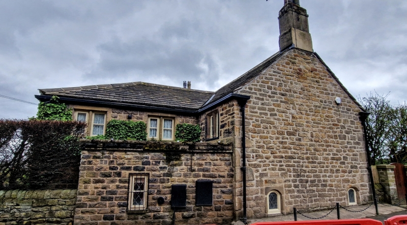
Entry Name: The Manor House
Listing Date: 7 April 1988
Grade: II
Source: Historic England
Source ID: 1262200
English Heritage Legacy ID: 433673
ID on this website: 101262200
Location: Hawksworth, Leeds, West Yorkshire, LS20
County: Leeds
Electoral Ward/Division: Guiseley and Rawdon
Parish: Non Civil Parish
Built-Up Area: Hawksworth
Traditional County: Yorkshire
Lieutenancy Area (Ceremonial County): West Yorkshire
Church of England Parish: Guiseley St Oswald King and Martyr
Church of England Diocese: Leeds
Tagged with: House
AIREBOROUGH MAIN STREET SE 14 SE LS 20 (south side) Hawksworth 4/63 The Manor House GV II
Farmhouse, now house. C17, altered. Coursed squared sandstone, stone slate roof. Rectangular 2-unit plan. Two storeys; single-storey gabled porch offset left of centre, with outer doorway in left side, to left of this a double-chamfered mullioned window on each floor, 4 lights at ground floor and 2 lights above, but both lengthened downwards; to the right a similarly altered 2-light window, a 2-light fire window near the corner, and a modern 3-light window above. Gable chimneys. Left gable (to road) rendered, with 2 small round-headed windows inserted at ground floor; right gable end has added conservatory. Rear has inter alia a small chamfered window at 1st floor, a similar blocked window to ground floor near the right-hand corner, probably formerly a firewindow (this feature, formerly covered by added outshut but exposed when this was demolished for rebuilding at time of survey).
Interior: 2 lateral beams with cyma-stopped small chamfer; in 2nd unit a large Tudor-arched stone fireplace; vaulted cellar beneath conservatory outside right-hand gable wall.
Listing NGR: SE1659941757
External links are from the relevant listing authority and, where applicable, Wikidata. Wikidata IDs may be related buildings as well as this specific building. If you want to add or update a link, you will need to do so by editing the Wikidata entry.


Other nearby listed buildings