Latitude: 51.3506 / 51°21'2"N
Longitude: -1.99 / 1°59'23"W
OS Eastings: 400792
OS Northings: 161276
OS Grid: SU007612
Mapcode National: GBR 2V1.7QB
Mapcode Global: VHB4G.GBB0
Plus Code: 9C3W9225+6X
Entry Name: 71 and 73, Southbroom Road
Listing Date: 19 September 1972
Grade: II
Source: Historic England
Source ID: 1262273
English Heritage Legacy ID: 435435
ID on this website: 101262273
Location: Devizes, Wiltshire, SN10
County: Wiltshire
Civil Parish: Devizes
Built-Up Area: Devizes
Traditional County: Wiltshire
Lieutenancy Area (Ceremonial County): Wiltshire
Tagged with: Building
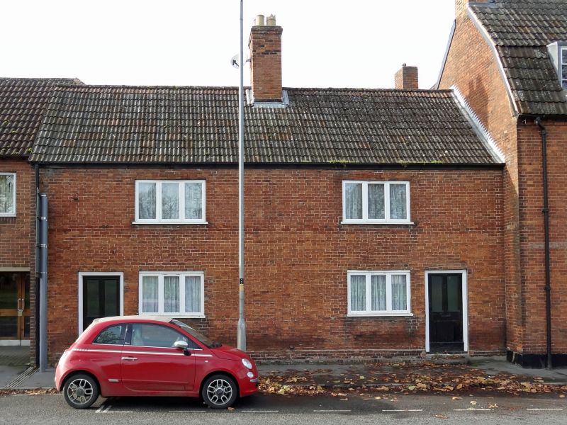
1.
1042 SOUTHBROOM ROAD
(West Side)
Nos 71 and 73
SU 0061 3a/198
II GV
2.
Formerly Nos 24 and 25 Southbroom Place.
Early Cl9 pair of cottages. Symmetrical 2 storeys red brick on small brick
plinth. Gable end pantile roof. Two 3 light casements to both floors.
2 recessed doors of 4 flush panels, 2 glazed, with moulded surrounds at outer
corners of building.
Nos 71 to 99 (odd ), The Volunteers Arms and Nos 103 to 113 (odd) form a group.
Listing NGR: SU0079261276
External links are from the relevant listing authority and, where applicable, Wikidata. Wikidata IDs may be related buildings as well as this specific building. If you want to add or update a link, you will need to do so by editing the Wikidata entry.


Other nearby listed buildings