Latitude: 51.1985 / 51°11'54"N
Longitude: 0.2755 / 0°16'31"E
OS Eastings: 559083
OS Northings: 146827
OS Grid: TQ590468
Mapcode National: GBR MP0.Y6K
Mapcode Global: VHHQ6.Q4JK
Plus Code: 9F3257XG+C6
Entry Name: 186, High Street
Listing Date: 30 October 1973
Grade: II
Source: Historic England
Source ID: 1262374
English Heritage Legacy ID: 435193
ID on this website: 101262374
Location: The Park, Tonbridge and Malling, Kent, TN9
County: Kent
District: Tonbridge and Malling
Electoral Ward/Division: Castle
Parish: Non Civil Parish
Built-Up Area: Tonbridge
Traditional County: Kent
Lieutenancy Area (Ceremonial County): Kent
Church of England Parish: Tonbridge St Peter and St Paul
Church of England Diocese: Rochester
1. HIGH STREET 1732 (West Side) No. 186 TQ 5946 NW 3/117
II GV
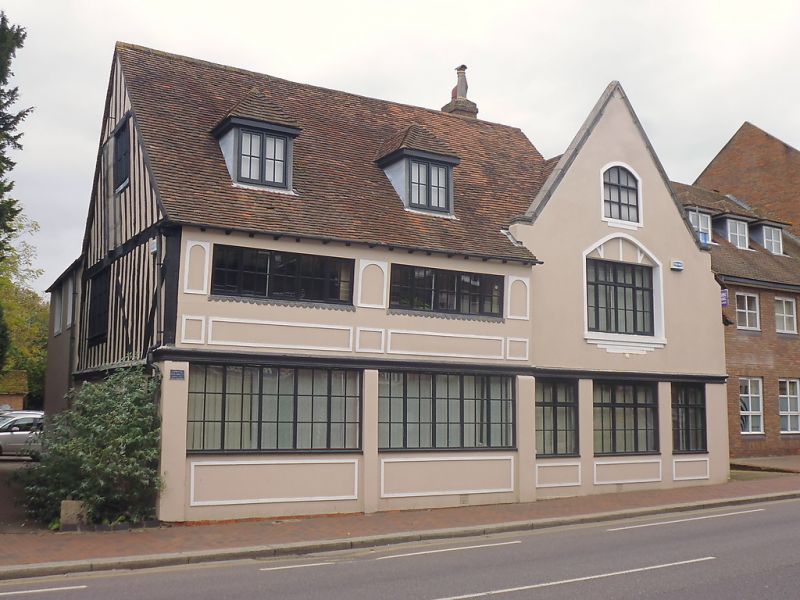
2. A late medieval possible open hall altered in C19. No. 186 consists of 4 different sections. The front elevation has a Mid C19 false front of 2 storeys and attics roughcast. Gable front with fleur de lys finial and kneelers. 1 double sash set in cambered head lining. C19 shopfront. Behind this is a portion of 2 storeys timber framed probably late C15 to early C16. The left side elevation is now faced with C19 brickwork and the right side elevation is tile-hung. Steeply pitched tiled roof. There is a later probably C17 massive brick chimney stack and later firegraters. Curved braces and an original wooden mullioned window. The roof is not visible as a ceiling has been inserted. To the rear of this section is a portion of 1 storey, late C15 to early C16 timber-framing but enclosed in brick in the C19. This has a steeply pitched tiled roof with 2 crown posts. These have curved braces on one side only. Probably in the C17 a massive red brick chimney stack was inserted but this falls short of the roof line. To the rear of this is a C19 stable of red brick with tiled roof.
Nos. 184, 184A, 184B, 186 and 188 form a group.
Listing NGR: TQ5907346828


Other nearby listed buildings