Latitude: 53.0232 / 53°1'23"N
Longitude: -1.0584 / 1°3'30"W
OS Eastings: 463253
OS Northings: 347738
OS Grid: SK632477
Mapcode National: GBR 9J7.H70
Mapcode Global: WHFHR.Q85P
Plus Code: 9C5W2WFR+7J
Entry Name: The Pinfold
Listing Date: 27 April 1987
Grade: II
Source: Historic England
Source ID: 1265305
English Heritage Legacy ID: 425423
ID on this website: 101265305
Location: Woodborough, Gedling, Nottinghamshire, NG14
County: Nottinghamshire
District: Gedling
Civil Parish: Woodborough
Built-Up Area: Woodborough
Traditional County: Nottinghamshire
Lieutenancy Area (Ceremonial County): Nottinghamshire
Church of England Parish: Woodborough
Church of England Diocese: Southwell and Nottingham
Tagged with: Architectural structure
SK 64 NW
5/160
WOODBOROUGH
MAIN STREET
(south side)
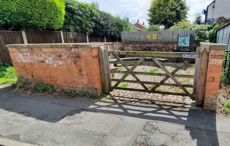
The Pinfold
II
Pinfold. Early C19, restored 1978. Brick with remains of
chamfered stone coping. Blue brick coping. Partly rendered.
Approx. 3M square.
Listing NGR: SK6325347738
External links are from the relevant listing authority and, where applicable, Wikidata. Wikidata IDs may be related buildings as well as this specific building. If you want to add or update a link, you will need to do so by editing the Wikidata entry.


Other nearby listed buildings