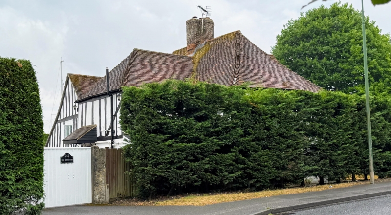
Latitude: 51.2544 / 51°15'15"N
Longitude: 0.5546 / 0°33'16"E
OS Eastings: 578358
OS Northings: 153686
OS Grid: TQ783536
Mapcode National: GBR PRG.90J
Mapcode Global: VHJMF.KQJQ
Plus Code: 9F327H33+QR
Entry Name: The Old Farmhouse
Listing Date: 30 July 1951
Grade: II
Source: Historic England
Source ID: 1266233
English Heritage Legacy ID: 421976
ID on this website: 101266233
Location: Shepway, Maidstone, Kent, ME15
County: Kent
District: Maidstone
Electoral Ward/Division: Shepway North
Parish: Non Civil Parish
Built-Up Area: Maidstone
Traditional County: Kent
Lieutenancy Area (Ceremonial County): Kent
Tagged with: Farmhouse
WILLINGTON STREET 1. 5278 (East Side) The Old Farmhouse TQ 75 8E 11/151 30.7.51. II
2. An L-shaped C16 timber-framed house restored and the ground floor rebuilt in red brick and mostly underbuilt but the north side of the west wing still retains the overhang of its lst floor on the protruding ends of tie floor joists. 1st floor tile-hung in front but the timbering exposed behind. Hipped tiled roof with 2 gabled dormers. 3 casement windows, some of these at the back pof the house with small square leaded panes. Gable on the north side.
Listing NGR: TQ7835853685
External links are from the relevant listing authority and, where applicable, Wikidata. Wikidata IDs may be related buildings as well as this specific building. If you want to add or update a link, you will need to do so by editing the Wikidata entry.


Other nearby listed buildings