Approximate Location Map
Large Map »
Latitude: 53.6451 / 53°38'42"N
Longitude: -1.7838 / 1°47'1"W
OS Eastings: 414388
OS Northings: 416532
OS Grid: SE143165
Mapcode National: GBR HVZ9.L2
Mapcode Global: WHCB1.KMSY
Plus Code: 9C5WJ6W8+2F
Entry Name: 6 and 7, Union Bank Yard
Listing Date: 29 September 1978
Grade: II
Source: Historic England
Source ID: 1267259
English Heritage Legacy ID: 419290
ID on this website: 101267259
Location: Huddersfield, Kirklees, West Yorkshire, HD1
County: Kirklees
Electoral Ward/Division: Newsome
Parish: Non Civil Parish
Built-Up Area: Huddersfield
Traditional County: Yorkshire
Lieutenancy Area (Ceremonial County): West Yorkshire
Church of England Parish: Huddersfield St Peter
Church of England Diocese: Leeds
Tagged with: Building
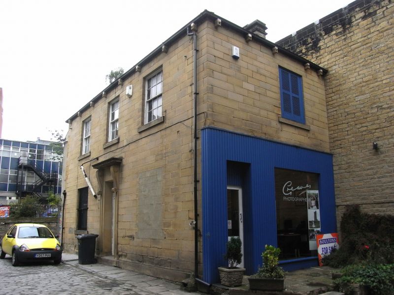
UNION BANK YARD
1.
5113
(West Side)
Nos 6 and 7
SE 1416 NW 1/1320
II GV
2.
Early C19. Ashlar. 2 storeys. 3 ranges of sashes with glazing bars. Door
in stone surround with sunk panels and cornice on tall consoles. Stone setts
and flags outside.
Listing NGR: SE1438816532
External links are from the relevant listing authority and, where applicable, Wikidata. Wikidata IDs may be related buildings as well as this specific building. If you want to add or update a link, you will need to do so by editing the Wikidata entry.


Other nearby listed buildings
