Latitude: 51.4582 / 51°27'29"N
Longitude: -2.112 / 2°6'43"W
OS Eastings: 392313
OS Northings: 173255
OS Grid: ST923732
Mapcode National: GBR 2SJ.DW2
Mapcode Global: VH96C.BLTZ
Plus Code: 9C3VFV5Q+75
Entry Name: Stable to the Old Vicarage and Attached Wall and Outbuilding
Listing Date: 16 September 1996
Grade: II
Source: Historic England
Source ID: 1267909
English Heritage Legacy ID: 462428
ID on this website: 101267909
Location: Chippenham, Wiltshire, SN15
County: Wiltshire
Civil Parish: Chippenham
Built-Up Area: Chippenham
Traditional County: Wiltshire
Lieutenancy Area (Ceremonial County): Wiltshire
Church of England Parish: Chippenham with Tytherton Lucas
Church of England Diocese: Bristol
Tagged with: Stable
CHIPPENHAM
ST9273SW ST MARY STREET 930-1/10/207 (North East side) Stable to The Old Vicarage and attached wall and outbuilding
GV II
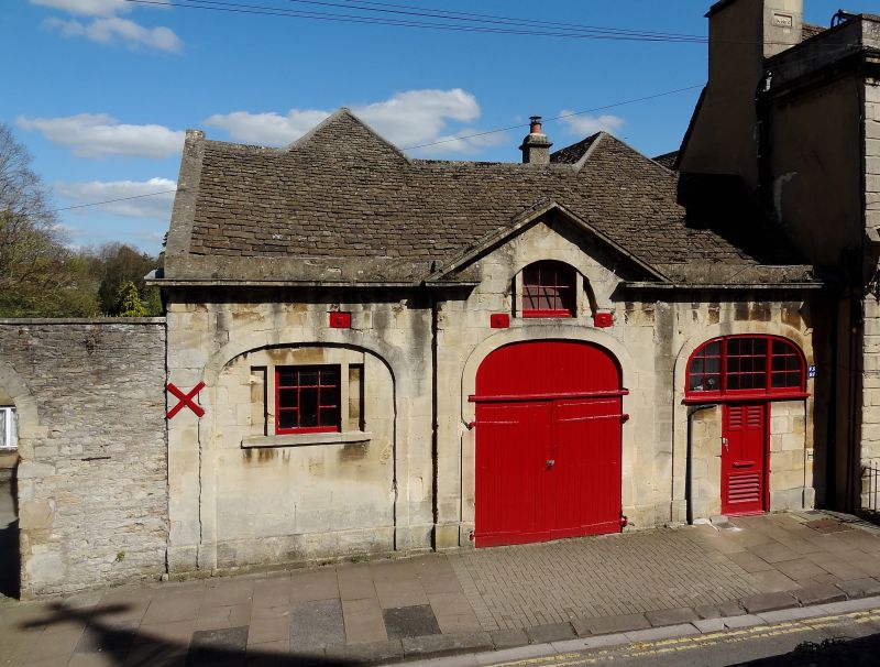
Stable block. Early C19. Limestone ashlar with a stone slate roof. T-plan. EXTERIOR: single-storey with attic; 3 bays. 3 full-height semi-elliptical recessed arches span the building. Above them the central bay is stepped very slightly forward with an open pediment flanked by a moulded cornice and blocking course. A semicircular recess in the tympanum has 2 plain mullions flanked by further recessed panels with a central planked door to a loading bay. Central C20 double garage doors have corrugated-iron infill to the arch. The arch to the left has a simulated tripartite window, 9 panes to the centre, blind windows to the sides. The right-hand arch has a 3-light window with small panes over a C20 door. INTERIOR: not inspected. SUBSIDIARY FEATURES: attached to the left (north) is a coped limestone rubble wall approx 4m high which extends approx 13m and has a semi-elliptical arch to a carriage entrance; then the gable end of a carriage house, with pantile roof and segmental-arched entry to left-hand return, and approx 8m of wall to where it has been cut down at the north end.
Listing NGR: ST9231373255
External links are from the relevant listing authority and, where applicable, Wikidata. Wikidata IDs may be related buildings as well as this specific building. If you want to add or update a link, you will need to do so by editing the Wikidata entry.


Other nearby listed buildings