Latitude: 51.5835 / 51°35'0"N
Longitude: -2.0978 / 2°5'51"W
OS Eastings: 393321
OS Northings: 187182
OS Grid: ST933871
Mapcode National: GBR 2QZ.QFP
Mapcode Global: VH95S.LGBG
Plus Code: 9C3VHWM2+9V
Entry Name: 10, High Street
Listing Date: 18 January 1949
Grade: II
Source: Historic England
Source ID: 1269394
English Heritage Legacy ID: 460806
ID on this website: 101269394
Location: Malmesbury, Wiltshire, SN16
County: Wiltshire
Civil Parish: Malmesbury
Built-Up Area: Malmesbury
Traditional County: Wiltshire
Lieutenancy Area (Ceremonial County): Wiltshire
Church of England Parish: Malmesbury and Brokenborough
Church of England Diocese: Bristol
Tagged with: Building
MALMESBURY
ST9387 HIGH STREET 758-1/4/142 (East side) 18/01/49 No.10
GV II
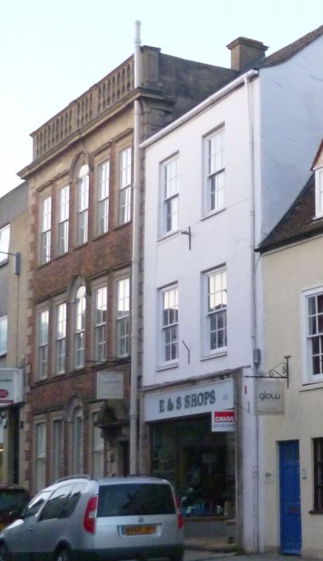
House, now offices. Early C18, altered mid C19. Red brick with limestone dressings. Double-depth plan with a right-hand side through-passage. 3 storeys; 5-window range. A near-symmetrical front has rusticated quoins to a coved cornice, and balustrade of stone splat balusters and panelled dies. A right-hand doorway has panelled jambs to bracketed swan's neck pediment and panelled door; windows have architraves and cornices, the central ones with keyed round-arched heads and matching hoods, to C20 sashes. INTERIOR: Central stair well divided by an elliptical arch, with a left-hand open well stair with column-on-vase balusters, wreathed, ramped and moulded rail; front ground-floor room has a cornice and fire surround with reeded jambs. Panelled rooms, described in original list not found. A fine early Georgian facade, making an important contribution to the street.
Listing NGR: ST9333087183
External links are from the relevant listing authority and, where applicable, Wikidata. Wikidata IDs may be related buildings as well as this specific building. If you want to add or update a link, you will need to do so by editing the Wikidata entry.


Other nearby listed buildings