Latitude: 51.5853 / 51°35'7"N
Longitude: -2.1014 / 2°6'5"W
OS Eastings: 393070
OS Northings: 187392
OS Grid: ST930873
Mapcode National: GBR 2QZ.HKD
Mapcode Global: VH95S.JFF0
Plus Code: 9C3VHVPX+4C
Entry Name: 80, GLOUCESTER ROAD (See details for further address information)
Listing Date: 1 July 1976
Grade: II
Source: Historic England
Source ID: 1269468
English Heritage Legacy ID: 460753
ID on this website: 101269468
Location: Malmesbury, Wiltshire, SN16
County: Wiltshire
Civil Parish: Malmesbury
Built-Up Area: Malmesbury
Traditional County: Wiltshire
Lieutenancy Area (Ceremonial County): Wiltshire
Church of England Parish: Malmesbury and Brokenborough
Church of England Diocese: Bristol
Tagged with: Building
MALMESBURY
ST9387 GLOUCESTER ROAD 758-1/2/91 (South side) 01/07/76 No.80
GV II
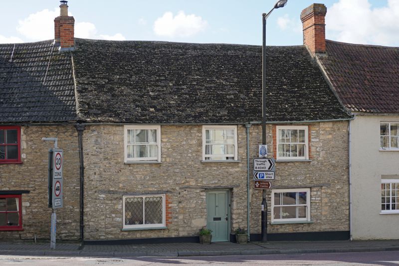
House. Late C16/early C17, altered late C18. Coursed limestone rubble with brick left-hand gable stack and stone slate roof. 2-room parallel plan with right-hand rear wing and left-hand rear outshut. 2 storeys; 3-window range. Timber lintels to a central doorway with recessed boarded door, and horned sashes with margin panes, a left-hand ground-floor plate-glass former shop window. INTERIOR: details include a good right-hand Tudor-arched stone fire surround with double ovolo moulding to diamond stops, chamfered axial ground-floor ceiling beam with bar stop, a C19 rear stair flight, 3-bay roof with collar trusses, the central pair cut, diagonal ridge beam, 2 trenched purlins, and a truss in the right-hand gable. First-floor scratch-moulded C17 6-panel door. Rear left-hand curved wall for former winder stair.
Listing NGR: ST9306687386
External links are from the relevant listing authority and, where applicable, Wikidata. Wikidata IDs may be related buildings as well as this specific building. If you want to add or update a link, you will need to do so by editing the Wikidata entry.


Other nearby listed buildings