Latitude: 52.4393 / 52°26'21"N
Longitude: -2.8358 / 2°50'8"W
OS Eastings: 343278
OS Northings: 282696
OS Grid: SO432826
Mapcode National: GBR BF.MDHL
Mapcode Global: VH766.SYNF
Plus Code: 9C4VC5Q7+PM
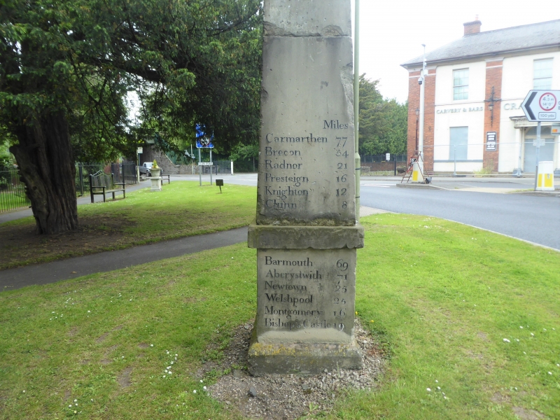
Entry Name: Milestone at Junction of A49 and B4368
Listing Date: 12 November 1954
Last Amended: 21 June 1996
Grade: II
Source: Historic England
Source ID: 1269930
English Heritage Legacy ID: 460263
Also known as: Milestone Obelisk. Craven Arms
ID on this website: 101269930
Location: Craven Arms, Shropshire, SY7
County: Shropshire
Civil Parish: Craven Arms
Built-Up Area: Craven Arms
Traditional County: Shropshire
Lieutenancy Area (Ceremonial County): Shropshire
Church of England Parish: Stokesay
Church of England Diocese: Hereford
Tagged with: Milestone
CRAVEN ARMS
SO48SW Milestone at junction of A49 and 1943-1/5/113 B4368 12/11/54 (Formerly Listed as: STOKESAY CRAVEN ARMS Milestone)
GV II
Milestone. Late C18. Ashlar sandstone obelisk, formerly limewashed. Approximately 6m high. Lists distances to 36 major towns and cities.
Listing NGR: SO4327882695
External links are from the relevant listing authority and, where applicable, Wikidata. Wikidata IDs may be related buildings as well as this specific building. If you want to add or update a link, you will need to do so by editing the Wikidata entry.


Other nearby listed buildings