Latitude: 50.1594 / 50°9'33"N
Longitude: -5.0743 / 5°4'27"W
OS Eastings: 180508
OS Northings: 33343
OS Grid: SW805333
Mapcode National: GBR ZD.T284
Mapcode Global: FRA 088L.LXY
Plus Code: 9C2P5W5G+Q7
Entry Name: 12 and 13, Dunstanville Terrace
Listing Date: 10 September 1968
Last Amended: 24 April 1996
Grade: II
Source: Historic England
Source ID: 1270051
English Heritage Legacy ID: 460130
ID on this website: 101270051
Location: Falmouth, Cornwall, TR11
County: Cornwall
Civil Parish: Falmouth
Built-Up Area: Falmouth
Traditional County: Cornwall
Lieutenancy Area (Ceremonial County): Cornwall
Church of England Parish: Penwerris
Church of England Diocese: Truro
Tagged with: Building
FALMOUTH
SW8033SE DUNSTANVILLE TERRACE 843-1/5/85 Nos.12 AND 13 10/09/68 (Formerly Listed as: GREENBANK TERRACE Nos.12 AND 13)
GV II
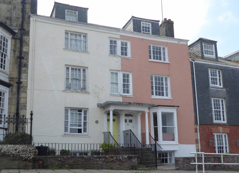
Formerly known as: Nos.12 AND 13 DUNSTANVILLE VILLAS. Pair of houses. Early C19. Render on rubble; asbestos slate roof with moulded eaves cornice; brick end stacks; 2 slate-hung hipped roof dormers. Double-depth plan. 3 storeys plus attic over basement; 3-window range. Original tripartite sash with glazing bars to 2nd-floor left, otherwise later horned copies (paired sashes over doorways) except for late C19 canted oriel to ground-floor right. Pair of elliptical-arched fanlights over 6-panel doors within wide distyle Tuscan porch with moulded entablature and deep soffit approached by flight of granite steps flanked by ramped wrought-iron railings. INTERIOR not inspected but likely to be of interest.
Listing NGR: SW8050833343
External links are from the relevant listing authority and, where applicable, Wikidata. Wikidata IDs may be related buildings as well as this specific building. If you want to add or update a link, you will need to do so by editing the Wikidata entry.


Other nearby listed buildings