Approximate Location Map
Large Map »
Latitude: 50.1507 / 50°9'2"N
Longitude: -5.0632 / 5°3'47"W
OS Eastings: 181264
OS Northings: 32336
OS Grid: SW812323
Mapcode National: GBR ZD.TR5R
Mapcode Global: FRA 088M.C8K
Plus Code: 9C2P5W2P+7P
Entry Name: The Killigrew Monument
Listing Date: 10 September 1968
Grade: II
Source: Historic England
Source ID: 1270063
English Heritage Legacy ID: 460142
ID on this website: 101270063
Location: Falmouth, Cornwall, TR11
County: Cornwall
Civil Parish: Falmouth
Built-Up Area: Falmouth
Traditional County: Cornwall
Lieutenancy Area (Ceremonial County): Cornwall
Church of England Parish: Falmouth King Charles the Martyr
Church of England Diocese: Truro
Tagged with: Monument
FALMOUTH
SW8132SW GROVE PLACE
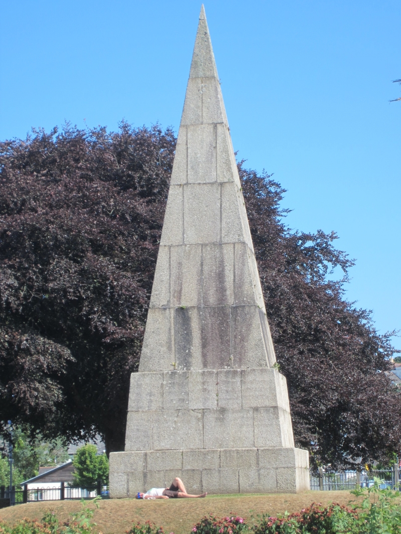
843-1/11/102 The Killigrew Monument
10/09/68
GV II
Monument. 1737, resited for the 2nd time in 1871. Erected by
Martin Killigrew to the memory of Sir Peter Killigrew of
Arwenack. Dressed granite steep pyramidal "obelisk",
13m high on stepped square-on-plan base.
(Kelly: Kelly's Directory for Cornwall: London: 1910-: 106).
Listing NGR: SW8126432336
External links are from the relevant listing authority and, where applicable, Wikidata. Wikidata IDs may be related buildings as well as this specific building. If you want to add or update a link, you will need to do so by editing the Wikidata entry.


Other nearby listed buildings
