Latitude: 52.7083 / 52°42'29"N
Longitude: -2.7438 / 2°44'37"W
OS Eastings: 349845
OS Northings: 312553
OS Grid: SJ498125
Mapcode National: GBR BJ.2K5T
Mapcode Global: WH8BT.T6M2
Plus Code: 9C4VP754+8F
Entry Name: Building to the Rear of Number 1A
Listing Date: 17 November 1995
Grade: II
Source: Historic England
Source ID: 1270757
English Heritage Legacy ID: 457384
ID on this website: 101270757
Location: Cherry Orchard, Shropshire, SY2
County: Shropshire
Civil Parish: Shrewsbury
Built-Up Area: Shrewsbury
Traditional County: Shropshire
Lieutenancy Area (Ceremonial County): Shropshire
Church of England Parish: Shrewsbury Holy Cross
Church of England Diocese: Lichfield
Tagged with: Building
SHREWSBURY
SJ4912NE HORSEFAIR 653-1/12/783 (South side) Building to the rear of No.1A
II
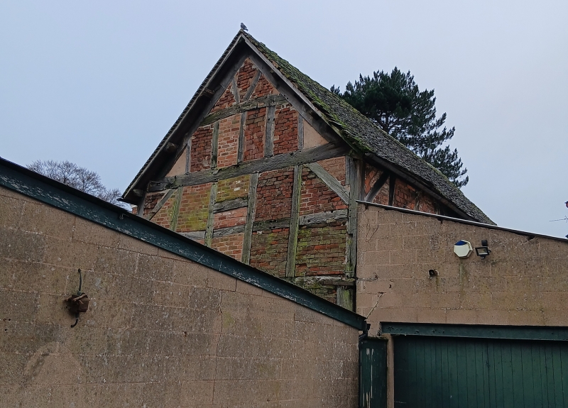
Warehouse, original use unknown, but non-domestic, and perhaps agricultural or storage. Early C17. Timber-framed with plain tiled roof. 2 storeys, undivided internally on each floor. Timber-framed in square panels with some tension bracing, and arch bracing in gable walls. 5 bays, the roof trusses showing evidence of alterations perhaps associated with raising the height of the roof: the tie beams which are below the level of the wall plate, are linked to a collar by a raking brace, itself braced to the wall plate. 2 purlins each side, and wind braces. There is little structural evidence for the original use of the building, but the absence of stack, and its position behind the main building line, suggests that it was originally a service building.
Listing NGR: SJ4984512553
External links are from the relevant listing authority and, where applicable, Wikidata. Wikidata IDs may be related buildings as well as this specific building. If you want to add or update a link, you will need to do so by editing the Wikidata entry.


Other nearby listed buildings