Latitude: 53.4746 / 53°28'28"N
Longitude: -2.2558 / 2°15'20"W
OS Eastings: 383117
OS Northings: 397566
OS Grid: SJ831975
Mapcode National: GBR DGK.7G
Mapcode Global: WHB9G.BX1Q
Plus Code: 9C5VFPFV+RM
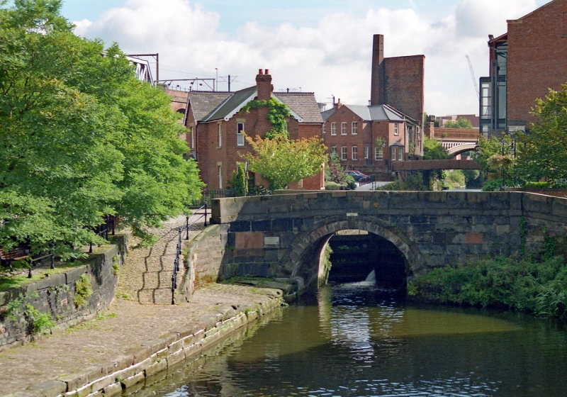
Entry Name: Rochdale Canal Lock Number 92 and Castle Street Bridge
Listing Date: 20 June 1988
Last Amended: 6 June 1994
Grade: II
Source: Historic England
Source ID: 1270858
English Heritage Legacy ID: 456985
Also known as: Lock 92, Rochdale Canal
Duke's Lock
Canal Street Bridge
ID on this website: 101270858
Location: Manchester, Greater Manchester, M3
County: Manchester
Electoral Ward/Division: City Centre
Parish: Non Civil Parish
Built-Up Area: Manchester
Traditional County: Lancashire
Lieutenancy Area (Ceremonial County): Greater Manchester
Church of England Parish: Manchester St Ann
Church of England Diocese: Manchester
MANCHESTER
SJ8397NW ROCHDALE CANAL 698-1/30/364 Lock No.92 and Castle Street Bridge 20/06/88 (Formerly Listed as: CASTLE STREET, CASTLEFIELD "Canal Bridge and over Rochdale Canal adjoining lock walls with 2 pairs..gates")
GV II
Canal bridge with attached ramp on west side and lock on east side. c.1804, altered. Coursed squared millstone grit, wooden gates. The bridge has a single segmental arch with rusticated voussoirs, keystone and arch-band, a plain band above, slab-wall parapets curved round at the outer ends, and a ramp at right-angles to the north-west corner. Lock of 14-foot width, with pairs of gates at both ends; overflow tunnel with circular brick-lined shaft to south side of Castle Street. The lock is the last in a series of 9 on the extension linking the Rochdale and Bridgewater Canals.
Listing NGR: SJ8311797566
External links are from the relevant listing authority and, where applicable, Wikidata. Wikidata IDs may be related buildings as well as this specific building. If you want to add or update a link, you will need to do so by editing the Wikidata entry.


Other nearby listed buildings