Latitude: 53.3925 / 53°23'33"N
Longitude: -1.4781 / 1°28'40"W
OS Eastings: 434807
OS Northings: 388539
OS Grid: SK348885
Mapcode National: GBR 9FF.MN
Mapcode Global: WHDDH.8ZFL
Plus Code: 9C5W9GVC+2Q
Entry Name: Rutland Road Bridge
Listing Date: 12 December 1995
Grade: II
Source: Historic England
Source ID: 1271002
English Heritage Legacy ID: 456385
ID on this website: 101271002
Location: Neepsend, Sheffield, South Yorkshire, S3
County: Sheffield
Electoral Ward/Division: City
Parish: Non Civil Parish
Built-Up Area: Sheffield
Traditional County: Yorkshire
Lieutenancy Area (Ceremonial County): South Yorkshire
Church of England Parish: Pitsmoor Christ Church
Church of England Diocese: Sheffield
Tagged with: Road bridge
SHEFFIELD
SK38NW RUTLAND ROAD 784-1/5/639 Rutland Road Bridge
II
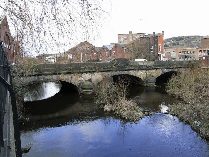
Road bridge spanning River Don. 1854, parapet rebuilt following flood, 1864. Ashlar. 3 elliptical arches with voussoirs and cutwaters with rounded ends. Parapet wall with moulded top and central flat topped panelled gable. 4 corner piers with moulded caps, one of them missing.
Listing NGR: SK3480788539
External links are from the relevant listing authority and, where applicable, Wikidata. Wikidata IDs may be related buildings as well as this specific building. If you want to add or update a link, you will need to do so by editing the Wikidata entry.


Other nearby listed buildings