Approximate Location Map
Large Map »
Latitude: 50.7306 / 50°43'50"N
Longitude: -1.1635 / 1°9'48"W
OS Eastings: 459130
OS Northings: 92662
OS Grid: SZ591926
Mapcode National: GBR 9CN.0NC
Mapcode Global: FRA 87G4.SMR
Plus Code: 9C2WPRJP+6H
Entry Name: Churchyard Wall of St Thomas's Church
Listing Date: 18 May 1972
Grade: II
Source: Historic England
Source ID: 1274671
English Heritage Legacy ID: 414508
ID on this website: 101274671
Location: Ryde, Isle of Wight, PO33
County: Isle of Wight
Civil Parish: Ryde
Built-Up Area: Ryde
Traditional County: Hampshire
Lieutenancy Area (Ceremonial County): Isle of Wight
Church of England Parish: Ryde
Church of England Diocese: Portsmouth
Tagged with: Churchyard wall
ST THOMAS'S STREET
1.
1577
(East Side)
Churchyard Wall of St Thomas's
Church
SZ 5992 3/65A
II
2.
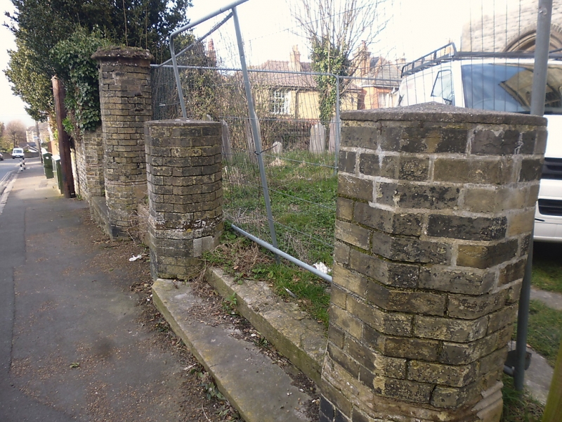
Stone rubble wall along St Thomas's Street and round into St Thomas's Square.
Octagononal brick piers with cast iron railings and gates opposite West Door.
Listing NGR: SZ5913092662
External links are from the relevant listing authority and, where applicable, Wikidata. Wikidata IDs may be related buildings as well as this specific building. If you want to add or update a link, you will need to do so by editing the Wikidata entry.


Other nearby listed buildings
