Approximate Location Map
Large Map »
Latitude: 53.6283 / 53°37'42"N
Longitude: -1.7486 / 1°44'54"W
OS Eastings: 416724
OS Northings: 414675
OS Grid: SE167146
Mapcode National: GBR JV7H.72
Mapcode Global: WHCB8.32M8
Plus Code: 9C5WJ7H2+8H
Entry Name: 14 and 16, Sharp Lane
Listing Date: 29 September 1978
Grade: II
Source: Historic England
Source ID: 1275029
English Heritage Legacy ID: 413504
ID on this website: 101275029
Location: Almondbury Common, Kirklees, West Yorkshire, HD4
County: Kirklees
Electoral Ward/Division: Almondbury
Parish: Non Civil Parish
Built-Up Area: Huddersfield
Traditional County: Yorkshire
Lieutenancy Area (Ceremonial County): West Yorkshire
Church of England Parish: Almondbury with Farnley Tyas Team Parish
Church of England Diocese: Leeds
Tagged with: Building
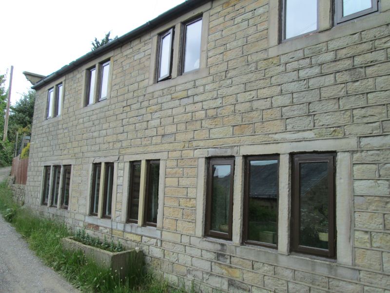
SHARP LANE
1.
5113
(West Side)
Almondbury
Nos 14 and 16
SE 1614 45/1195
II
2.
C19. Hammer dressed stone. Pitched stone slate roof. Coped gable ends on
moulded kneelers. 2 storeys. Four 2-light stone mullioned windows on 1st
floor. Two 3-light stone mullioned windows on ground floor.
Listing NGR: SE1672414675
External links are from the relevant listing authority and, where applicable, Wikidata. Wikidata IDs may be related buildings as well as this specific building. If you want to add or update a link, you will need to do so by editing the Wikidata entry.


Other nearby listed buildings
