Approximate Location Map
Large Map »
Latitude: 53.6126 / 53°36'45"N
Longitude: -1.8302 / 1°49'48"W
OS Eastings: 411330
OS Northings: 412907
OS Grid: SE113129
Mapcode National: GBR HVNN.KQ
Mapcode Global: WHCB6.VGNC
Plus Code: 9C5WJ579+2W
Entry Name: Drinking Trough at Crab Tree Well
Listing Date: 29 September 1978
Grade: II
Source: Historic England
Source ID: 1275264
English Heritage Legacy ID: 412954
ID on this website: 101275264
Location: South Crosland, Kirklees, West Yorkshire, HD4
County: Kirklees
Electoral Ward/Division: Crosland Moor and Netherton
Parish: Non Civil Parish
Built-Up Area: Netherton
Traditional County: Yorkshire
Lieutenancy Area (Ceremonial County): West Yorkshire
Church of England Parish: South Crosland Holy Trinity
Church of England Diocese: Leeds
Tagged with: Manger
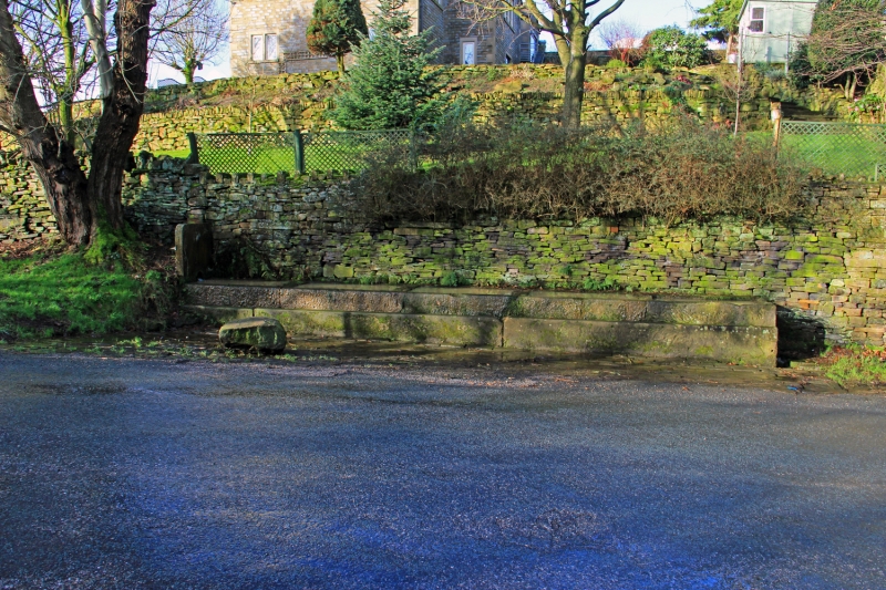
SCHOOL HILL
1.
5113
South Crosland
Drinking trough at
Crab Tree Well
SE 1112 50/1190
II
2.
C18 or C19. 5 separate monolithic troughs linked by cast iron conduits. Dry
stone retaining wall behind.
Listing NGR: SE1133012907
External links are from the relevant listing authority and, where applicable, Wikidata. Wikidata IDs may be related buildings as well as this specific building. If you want to add or update a link, you will need to do so by editing the Wikidata entry.


Other nearby listed buildings
