Approximate Location Map
Large Map »
Latitude: 51.0093 / 51°0'33"N
Longitude: 0.5026 / 0°30'9"E
OS Eastings: 575662
OS Northings: 126303
OS Grid: TQ756263
Mapcode National: GBR PV9.MWS
Mapcode Global: FRA C6YF.TYJ
Plus Code: 9F322G53+P2
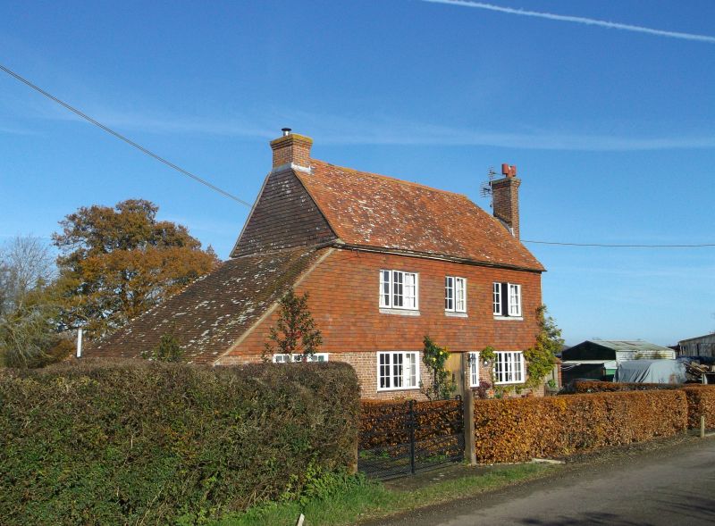
Entry Name: Climsett's Farmhouse
Listing Date: 13 May 1987
Grade: II
Source: Historic England
Source ID: 1275287
English Heritage Legacy ID: 412901
ID on this website: 101275287
Location: Rother, East Sussex, TN32
County: East Sussex
District: Rother
Civil Parish: Salehurst and Robertsbridge
Traditional County: Sussex
Lieutenancy Area (Ceremonial County): East Sussex
Church of England Parish: Salehurst St Mary
Church of England Diocese: Chichester
Tagged with: Farmhouse
TQ 72 NE SALEHURST BODIAM ROAD
6/6 Climsett's Farmhouse
II
C18 or earlier. 2 storeys. 3 windows. Ground floor red brick and grey headers,
above tile-hung. Tiled roof. Casement windows.
Listing NGR: TQ7566226303
External links are from the relevant listing authority and, where applicable, Wikidata. Wikidata IDs may be related buildings as well as this specific building. If you want to add or update a link, you will need to do so by editing the Wikidata entry.


Other nearby listed buildings
