Approximate Location Map
Large Map »
Latitude: 50.9847 / 50°59'5"N
Longitude: 0.6043 / 0°36'15"E
OS Eastings: 582889
OS Northings: 123822
OS Grid: TQ828238
Mapcode National: GBR QX4.3LL
Mapcode Global: FRA D64H.Z39
Plus Code: 9F22XJM3+VP
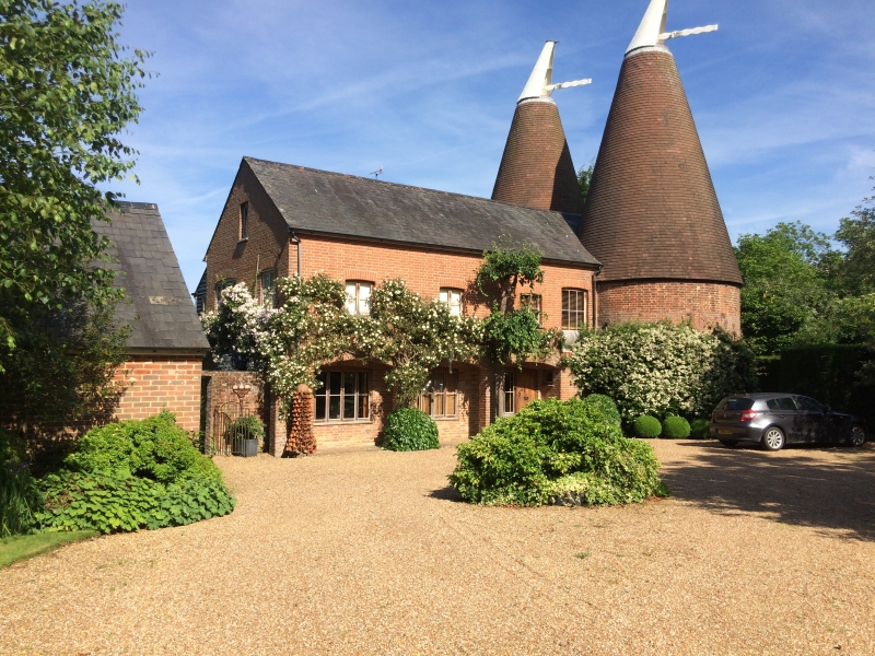
Entry Name: Carriers Oast
Listing Date: 13 May 1987
Grade: II
Source: Historic England
Source ID: 1275833
English Heritage Legacy ID: 411161
ID on this website: 101275833
Location: Mill Corner, Rother, East Sussex, TN31
County: East Sussex
District: Rother
Civil Parish: Northiam
Traditional County: Sussex
Lieutenancy Area (Ceremonial County): East Sussex
Church of England Parish: Northiam St Mary
Church of England Diocese: Chichester
Tagged with: Architectural structure
TQ 82 SW NORTHIAM HASTINGS ROAD
14/36 Carriers Oast
II
Two round oasthouses and a granary converted into a house. C19. Red brick. The
oasts have modern tiled roofs. The granary has a slate roof. The ground floor
has been set back in arcading. Two storeys. Four windows.
Listing NGR: TQ8288923822
External links are from the relevant listing authority and, where applicable, Wikidata. Wikidata IDs may be related buildings as well as this specific building. If you want to add or update a link, you will need to do so by editing the Wikidata entry.


Other nearby listed buildings
