Approximate Location Map
Large Map »
Latitude: 52.1715 / 52°10'17"N
Longitude: -2.5877 / 2°35'15"W
OS Eastings: 359906
OS Northings: 252741
OS Grid: SO599527
Mapcode National: GBR FR.58RV
Mapcode Global: VH855.3PC6
Plus Code: 9C4V5CC6+HW
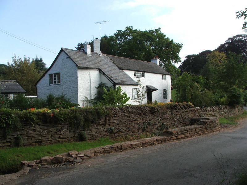
Entry Name: The White House
Listing Date: 12 April 1973
Grade: II
Source: Historic England
Source ID: 1276190
English Heritage Legacy ID: 410192
ID on this website: 101276190
Location: Pencombe, County of Herefordshire, HR7
County: County of Herefordshire
Civil Parish: Pencombe with Grendon Warren
Traditional County: Herefordshire
Lieutenancy Area (Ceremonial County): Herefordshire
Church of England Parish: Pencombe with Marston Stannett
Church of England Diocese: Hereford
Tagged with: House
1.
1962 PENCOMBE AND
GRENDON WARREN PENCOMBE
The White House
SO 55 SE 11/514
II
2.
C17/18 cottage. Painted stone rubble with timber frame exposed at rear.
Two storeys. Three casement windows. Slate roof.
Listing NGR: SO5990652741
External links are from the relevant listing authority and, where applicable, Wikidata. Wikidata IDs may be related buildings as well as this specific building. If you want to add or update a link, you will need to do so by editing the Wikidata entry.


Other nearby listed buildings
