Latitude: 51.4775 / 51°28'38"N
Longitude: -2.4535 / 2°27'12"W
OS Eastings: 368604
OS Northings: 175485
OS Grid: ST686754
Mapcode National: GBR JX.L3K9
Mapcode Global: VH88Q.F496
Plus Code: 9C3VFGGW+XJ
Entry Name: Well House About 100 Yards North West of the Grange
Listing Date: 15 July 1981
Grade: II
Source: Historic England
Source ID: 1278093
English Heritage Legacy ID: 406667
ID on this website: 101278093
Location: Siston, South Gloucestershire, BS16
County: South Gloucestershire
Civil Parish: Siston
Traditional County: Gloucestershire
Lieutenancy Area (Ceremonial County): Gloucestershire
Church of England Parish: Syston
Church of England Diocese: Bristol
Tagged with: Architectural structure
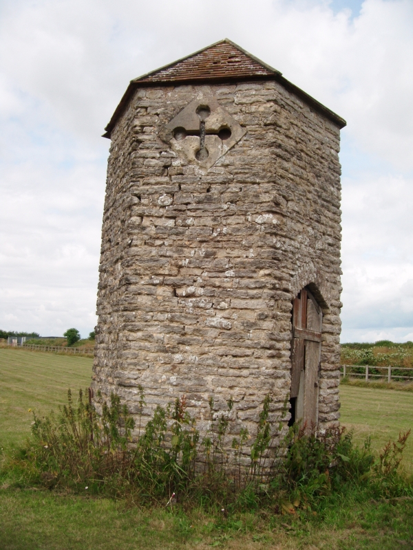
1.
5118 SISTON SISTON VILLAGE
Well-house about 100 yds
north-west of The
Grange
ST 67 NE 2/226
II GV
2.
Probably 1880s or 1840s. Gothick. Unusually tall (about 13 ft) rubble
hexagonal building with pyramidal roof. Arched door to east, cross-loop
to south.
Listing NGR: ST6860475485
External links are from the relevant listing authority and, where applicable, Wikidata. Wikidata IDs may be related buildings as well as this specific building. If you want to add or update a link, you will need to do so by editing the Wikidata entry.


Other nearby listed buildings