Approximate Location Map
Large Map »
Latitude: 51.7553 / 51°45'18"N
Longitude: -1.2564 / 1°15'22"W
OS Eastings: 451425
OS Northings: 206546
OS Grid: SP514065
Mapcode National: GBR 8YY.TDC
Mapcode Global: VHCXV.54NR
Plus Code: 9C3WQP4V+4C
Entry Name: Trinity College, Gateway to Garden Between East Range and the Presidents Lodging
Listing Date: 28 June 1972
Grade: II
Source: Historic England
Source ID: 1278361
English Heritage Legacy ID: 405938
ID on this website: 101278361
Location: Oxford, Oxfordshire, OX1
County: Oxfordshire
District: Oxford
Electoral Ward/Division: Carfax
Parish: Non Civil Parish
Built-Up Area: Oxford
Traditional County: Oxfordshire
Lieutenancy Area (Ceremonial County): Oxfordshire
Church of England Parish: Oxford St Mary Magdalen
Church of England Diocese: Oxford
Tagged with: Architectural structure
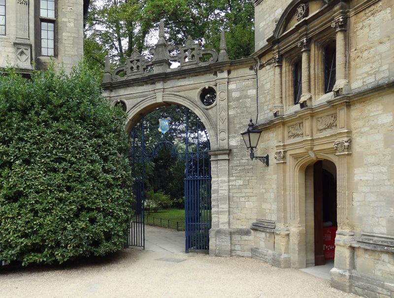
TRINITY COLLEGE
1.
1485
Front Quadrangle
Gateway to garden
between the East range
and the President's Lodging
SP 5lO6 NW 5/139K
II
2.
1757. Baroque type. Stone arch with finials. Wrought-iron gates.
Listing NGR: SP5142606545
External links are from the relevant listing authority and, where applicable, Wikidata. Wikidata IDs may be related buildings as well as this specific building. If you want to add or update a link, you will need to do so by editing the Wikidata entry.


Other nearby listed buildings
