Approximate Location Map
Large Map »
Latitude: 50.8645 / 50°51'52"N
Longitude: -4.529 / 4°31'44"W
OS Eastings: 222128
OS Northings: 110265
OS Grid: SS221102
Mapcode National: GBR K3.TSLH
Mapcode Global: FRA 16DT.9DX
Plus Code: 9C2QVF7C+QC
Entry Name: Scadghill Farmhouse
Listing Date: 9 September 1985
Grade: II
Source: Historic England
Source ID: 1278622
English Heritage Legacy ID: 64819
ID on this website: 101278622
Location: Stibb, Cornwall, EX23
County: Cornwall
Civil Parish: Kilkhampton
Traditional County: Cornwall
Lieutenancy Area (Ceremonial County): Cornwall
Church of England Parish: Kilkhampton
Church of England Diocese: Truro
Tagged with: Farmhouse
SS 21 SW KILKHAMPTON
3/10 Scadghill Farmhouse
-
- II
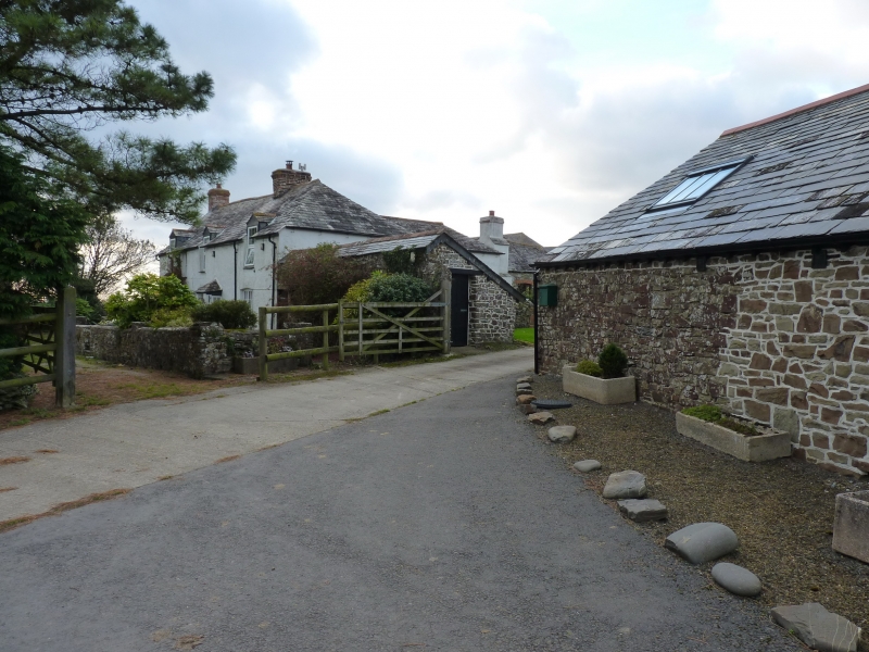
Farmhouse. C17 origins, late C19 alterations. Whitewashed rendered stone,
slate roof hipped at right end, gabled at left. 2 brick chimneys, 1 rendered
projecting stack to rear wing. Single depth main range with baffle entry. Rear
stone stair parallel to rear wall, or possibly winder stair, formerly external to
main range, now in rear wing. Former hall and inner room now undivided. Rear wing
under 2 span hipped roof forms T plan. Pantry under rear left span. 2 storey
front with off-centre porch with pyramidal slated roof. 3 ground floor timber
casements, 2 to left of porch, 1 to right, each a 3-light casement, 6 panes per
light under a segmental head. 4 first floor windows: 1, 3 and 4 late C19 full
dormers with pairs of 6 pane timber sashes with horns. Second window from the left
in a pair of 3 pane sashes with horns. Break in plane of front to left of porch
suggests rebuilding, probably at right end. Room to left of entry has large
fireplace, freestone rubble jambs and massive chamfered granite lintel, slate
floor. Pantry to rear left has slate floor and slate-topped benches and table.
Timber stairs above stone stairs. On the Gascoyne map of the Grenville Estate in
1694 'Uper Scadgell' is shown as a range with projecting wing and smaller range
parallel to the main range.
Listing NGR: SS2212810265
External links are from the relevant listing authority and, where applicable, Wikidata. Wikidata IDs may be related buildings as well as this specific building. If you want to add or update a link, you will need to do so by editing the Wikidata entry.


Other nearby listed buildings
