Latitude: 52.5859 / 52°35'9"N
Longitude: -2.1273 / 2°7'38"W
OS Eastings: 391473
OS Northings: 298687
OS Grid: SO914986
Mapcode National: GBR 1DK.HD
Mapcode Global: WHBFZ.988D
Plus Code: 9C4VHVPF+93
Entry Name: Lloyds Bank
Listing Date: 12 February 1975
Grade: II
Source: Historic England
Source ID: 1279604
English Heritage Legacy ID: 378535
ID on this website: 101279604
Location: Wolverhampton, West Midlands, WV1
County: City of Wolverhampton
Electoral Ward/Division: St Peter's
Parish: Non Civil Parish
Built-Up Area: Wolverhampton
Traditional County: Staffordshire
Lieutenancy Area (Ceremonial County): West Midlands
Church of England Parish: Central Wolverhampton
Church of England Diocese: Lichfield
Tagged with: Bank building
WOLVERHAMPTON
SO9198NW QUEEN SQUARE 895-1/11/285 (East side) 12/02/75 Lloyds Bank
GV II
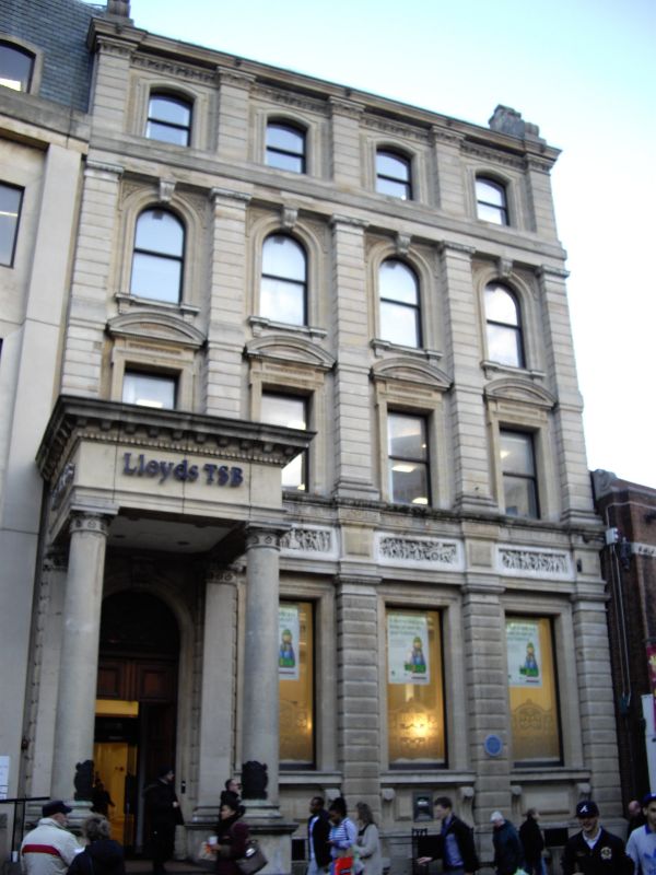
Formerly known as: Premises occupied by Lloyds Bank DUDLEY STREET. Bank. 1878, later C19 top storey. By J.A.Chatwin. Ashlar. Italianate style. 4 storeys; 4-bay range. Moulded plinth, rusticated pilasters, entablature to ground floor and top cornice. Tall ground floor has etched plate glass windows with architraves and fielded apron panels, one removed for cashcard machine; entablature has relief panels illustrating coal mining, agriculture and engineering to frieze; Greek key cornice. Giant pilasters to 1st and 2nd floors; 1st floor windows have eared architraves, friezes with enriched panels and segmental pediments; 2nd floor has round-headed windows with console keystones and enriched spandrels; rusticated band above; 3rd floor has segmental-headed windows with flanking guilloche strips, some foliage enrichment to cornice; scrolled end terminals. Round-headed entrance to 1st bay has architrave and keystone; Doric porch, the columns on plinths and with paterae to capitals, Ionic entablature. INTERIOR has Ionic pilasters and cornices carried round beams.
Listing NGR: SO9147398687
External links are from the relevant listing authority and, where applicable, Wikidata. Wikidata IDs may be related buildings as well as this specific building. If you want to add or update a link, you will need to do so by editing the Wikidata entry.


Other nearby listed buildings