Latitude: 51.9976 / 51°59'51"N
Longitude: -0.9899 / 0°59'23"W
OS Eastings: 469442
OS Northings: 233726
OS Grid: SP694337
Mapcode National: GBR 9XQ.NK7
Mapcode Global: VHDT8.S1JY
Plus Code: 9C3XX2X6+32
Entry Name: 2, 3 and 4, Church Street
Listing Date: 3 April 1973
Grade: II
Source: Historic England
Source ID: 1281138
English Heritage Legacy ID: 377140
ID on this website: 101281138
Location: Buckingham, Buckinghamshire, MK18
County: Buckinghamshire
Civil Parish: Buckingham
Built-Up Area: Buckingham
Traditional County: Buckinghamshire
Lieutenancy Area (Ceremonial County): Buckinghamshire
Church of England Parish: Buckingham
Church of England Diocese: Oxford
Tagged with: Building
BUCKINGHAM
SP6933 CHURCH STREET 879-1/6/40 (West side) 03/04/73 Nos.2, 3 AND 4
GV II
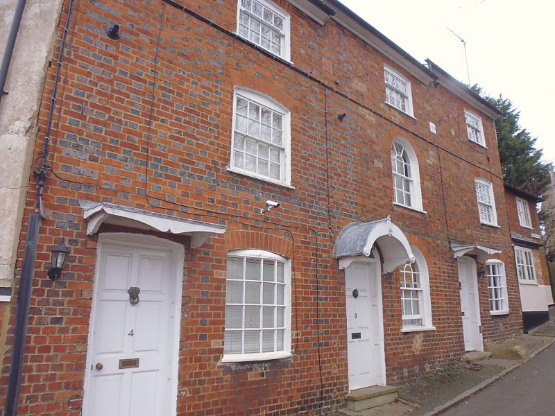
Terrace of 3 houses. Dated 1836, altered C20. Red brick in Flemish bond with flared headers, slate roof, brick ridge and end stacks. One-unit plans. 3-storey, 3-window range. Terrace steps downhill and has tripartite composition. 6-panel doors, that to left of centre (No.3) with fanlight, round-arched head and round hood on shaped brackets, those to left and right (Nos 4 & 2) have segmental-arched heads and straight hood on shaped brackets. Sash window to ground and 1st floor centre with round-arched heads, curved 12-pane sashes to 2nd floor with segmental-arched heads. Nos 2 & 3 have one stone step to doors; 2 steps to door of No.4. Painted stone plaque to left of centre inscribed J + H/Built, similar plaque to right of centre inscribed 1836. Boxed eaves. INTERIOR not inspected.
Listing NGR: SP6944233730
External links are from the relevant listing authority and, where applicable, Wikidata. Wikidata IDs may be related buildings as well as this specific building. If you want to add or update a link, you will need to do so by editing the Wikidata entry.


Other nearby listed buildings