Latitude: 51.4556 / 51°27'20"N
Longitude: -2.594 / 2°35'38"W
OS Eastings: 358821
OS Northings: 173127
OS Grid: ST588731
Mapcode National: GBR C8K.91
Mapcode Global: VH88M.ZNHZ
Plus Code: 9C3VFC44+69
Entry Name: 44, Broad Street
Listing Date: 4 March 1977
Grade: II
Source: Historic England
Source ID: 1282366
English Heritage Legacy ID: 379012
ID on this website: 101282366
Location: Bristol, BS1
County: City of Bristol
Electoral Ward/Division: Central
Parish: Non Civil Parish
Built-Up Area: Bristol
Traditional County: Gloucestershire
Lieutenancy Area (Ceremonial County): Bristol
Church of England Parish: Bristol St Stephen with St James and St John the Baptist with St Michael and St George
Church of England Diocese: Bristol
Tagged with: Building
BRISTOL
ST5873SE BROAD STREET, Centre 901-1/11/530 (North East side) 04/03/77 No.44
GV II
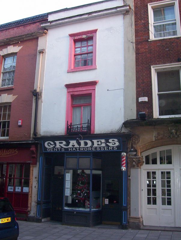
Attached house, now shop. Early C19. Render with limestone dressings, roof not visible. Single rooms front and rear with a central right-hand light well, and stair to the rear of the well. A fairly complete C19 shop front with left-hand door to the flat, right-hand to the shop, with a central plate-glass window and panelled pilasters to consoles and facia. Pilasters above to a cornice and parapet; architraves with a first-floor cornice to first-floor casements and second-floor 6/6-pane sashes. INTERIOR: extensively altered and re-roofed; an enclosed winder stair above the first floor and stair flight with winder top and bottom sections to the front, with a central well. (Gomme A: Street Index of Buildings of Architectural or Historic Interest: 9).
Listing NGR: ST5882173127
External links are from the relevant listing authority and, where applicable, Wikidata. Wikidata IDs may be related buildings as well as this specific building. If you want to add or update a link, you will need to do so by editing the Wikidata entry.


Other nearby listed buildings