Latitude: 51.5969 / 51°35'48"N
Longitude: -1.1252 / 1°7'30"W
OS Eastings: 460690
OS Northings: 189038
OS Grid: SU606890
Mapcode National: GBR 911.Y1L
Mapcode Global: VHCYP.G404
Plus Code: 9C3WHVWF+QW
Entry Name: Angier's Almshouses
Listing Date: 9 December 1949
Last Amended: 9 February 1988
Grade: II
Source: Historic England
Source ID: 1284546
English Heritage Legacy ID: 249285
ID on this website: 101284546
Location: Wallingford, South Oxfordshire, OX10
County: Oxfordshire
District: South Oxfordshire
Civil Parish: Wallingford
Built-Up Area: Wallingford
Traditional County: Berkshire
Lieutenancy Area (Ceremonial County): Oxfordshire
Tagged with: Almshouse
WALLINGFORD READING ROAD SU6089SE (East side) Wallingford 11/120 Angler's Almshouses 09/12/49 (Formerly listed as Anglers Almshouses)
II
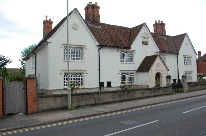
Almshouses. Dated 1681 to datestone inscribed "This hospital was built and endowed for ye reliefe of six poore people by Mr. William Angier and Mary his sister, Anno Domini 1681". Mr. Francis Bunting further endowed it with a gift of one thousand pounds. A.D. 1886" to first floor centre; early C19 windows and alterations; late C20 additions to rear. Coursed squared limestone plinth; roughcast, probably on limestone rubble; old plain-tile roof; brick ridge stacks to left and right of centre, and to rear left and right. U-shaped plan with cross-wings to rear. 2-storey, 4-window range. Ribbed and studded plank door with stuccoed gabled porch having round archway with keystone, impost blocks and plain surround. 3-light cast-iron casements with Gothick glazing bars and hood moulds to all openings. Paired plank hatches to ground floor left and right of centre. Cross-gables to left, right, and to centre. Ogee-topped datestone to centre cross-gable. Carved Tudor roses to left and right cross-gables, and to gable of porch. Interior not inspected. (V.C.H.: Berkshire, Vol.III, 1923, p.520-1).
Listing NGR: SU6069089038
External links are from the relevant listing authority and, where applicable, Wikidata. Wikidata IDs may be related buildings as well as this specific building. If you want to add or update a link, you will need to do so by editing the Wikidata entry.


Other nearby listed buildings