Latitude: 51.6464 / 51°38'46"N
Longitude: -1.1651 / 1°9'54"W
OS Eastings: 457865
OS Northings: 194505
OS Grid: SU578945
Mapcode National: GBR 90F.L8J
Mapcode Global: VHCY8.RWF8
Plus Code: 9C3WJRWM+HX
Entry Name: Wyndlesora
Listing Date: 9 November 1976
Grade: II
Source: Historic England
Source ID: 1285356
English Heritage Legacy ID: 248147
ID on this website: 101285356
Location: Dorchester, South Oxfordshire, OX10
County: Oxfordshire
District: South Oxfordshire
Civil Parish: Dorchester
Built-Up Area: Dorchester
Traditional County: Oxfordshire
Lieutenancy Area (Ceremonial County): Oxfordshire
Church of England Parish: Dorchester
Church of England Diocese: Oxford
Tagged with: Building
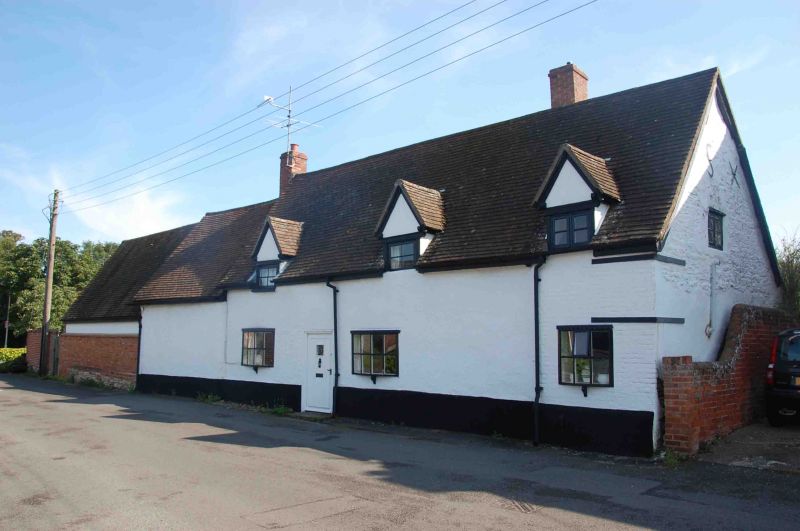
DORCHESTER QUEEN STREET SU5794 (East side) 5/116 No.26 (Wyndlesora) 09/11/76
- II
House. Late C17/early C18. Rendered walls, probably partly timber framed with some brick and rubble; plain-tile roof with brick stacks. 2-unit plan extended to 4 units. One storey plus attics. 3-window front has a central timber-framed section with a doorway between 2 small C20 bow windows; small brick and rubble bay to right has similar window; blind bay to left; 3 small gabled dormers. Roof has stacks flanking central section. Interior not inspected.
Listing NGR: SU5786594505
External links are from the relevant listing authority and, where applicable, Wikidata. Wikidata IDs may be related buildings as well as this specific building. If you want to add or update a link, you will need to do so by editing the Wikidata entry.


Other nearby listed buildings