Approximate Location Map
Large Map »
Latitude: 50.6976 / 50°41'51"N
Longitude: -3.1893 / 3°11'21"W
OS Eastings: 316100
OS Northings: 89338
OS Grid: SY161893
Mapcode National: GBR PB.1NCB
Mapcode Global: FRA 4767.HB4
Plus Code: 9C2RMRX6+27
Entry Name: Curtilage Wall Enclosing Property on North and East Sides and Including Gate Piers at Slade Farmhouse
Listing Date: 12 November 1973
Grade: II
Source: Historic England
Source ID: 1287447
English Heritage Legacy ID: 402398
ID on this website: 101287447
Location: Weston, East Devon, EX10
County: Devon
District: East Devon
Civil Parish: Sidmouth
Traditional County: Devon
Lieutenancy Area (Ceremonial County): Devon
Church of England Parish: Branscombe St Winifred
Church of England Diocese: Exeter
Tagged with: Wall
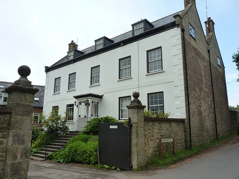
SLADE LANE, SALCOMBE
1.
1633
REGIS
Curtilage wall enclosing
property on north and
east sides and including
gate piers at Slade Farmhouse
SY 18 NE 15/167A
II
2.
High stone rubble wall with brick capping. Stone gate piers with ball
finials.
Listing NGR: SY1610089338
External links are from the relevant listing authority and, where applicable, Wikidata. Wikidata IDs may be related buildings as well as this specific building. If you want to add or update a link, you will need to do so by editing the Wikidata entry.


Other nearby listed buildings
