Latitude: 52.9231 / 52°55'23"N
Longitude: -1.4823 / 1°28'56"W
OS Eastings: 434903
OS Northings: 336310
OS Grid: SK349363
Mapcode National: GBR PJF.5J
Mapcode Global: WHDGT.6SDG
Plus Code: 9C4WWGF9+63
Entry Name: 114A-115, Friar Gate
Listing Date: 24 February 1977
Grade: II
Source: Historic England
Source ID: 1287560
English Heritage Legacy ID: 402032
ID on this website: 101287560
Location: Derby, Derbyshire, DE1
County: City of Derby
Electoral Ward/Division: Arboretum
Parish: Non Civil Parish
Built-Up Area: Derby
Traditional County: Derbyshire
Lieutenancy Area (Ceremonial County): Derbyshire
Church of England Parish: Derby St Alkmund and St Werburgh
Church of England Diocese: Derby
Tagged with: Building
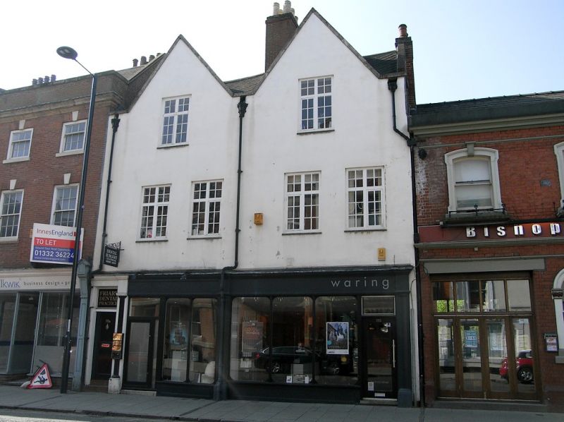
FRIAR GATE
1.
5170
(South Side)
Non Il4A and 115
SK 3436 SE 4/133
II Gv
2.
C17. Cement rendered; 3 storeys; 4 windows with wood mullions and transoms, and
one under each gable; 2 plain gables to front with stone copings; old slate roof.
Modern shop fronts.
Nos 114A, 115, 115A, 116, 117, 117A and 118 form a group.
Listing NGR: SK3490336310
External links are from the relevant listing authority and, where applicable, Wikidata. Wikidata IDs may be related buildings as well as this specific building. If you want to add or update a link, you will need to do so by editing the Wikidata entry.


Other nearby listed buildings