Latitude: 52.4873 / 52°29'14"N
Longitude: -1.9146 / 1°54'52"W
OS Eastings: 405893
OS Northings: 287714
OS Grid: SP058877
Mapcode National: GBR 5X6.47
Mapcode Global: VH9YW.RRN2
Plus Code: 9C4WF3PP+W4
Entry Name: 160, WARSTONE LANE B18 (See details for further address information)
Listing Date: 8 July 1982
Grade: II
Source: Historic England
Source ID: 1290165
English Heritage Legacy ID: 217739
ID on this website: 101290165
Location: Brookfields, Birmingham, West Midlands, B18
County: Birmingham
Parish: Non Civil Parish
Built-Up Area: Birmingham
Traditional County: Warwickshire
Lieutenancy Area (Ceremonial County): West Midlands
Church of England Parish: Birmingham St Paul
Church of England Diocese: Birmingham
Tagged with: Building
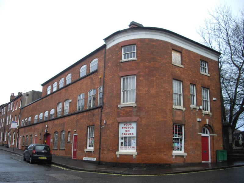
WARSTONE LANE 1. 5104 Hockley B18 No 160 SP 08 NE 7/89 II GV 2. Includes No 1 Warstone Parade. C1840-50 office/house with works range to Warstone Parade, balancing No 159 on opposite corner. Three storeys red brick with bowed corner, the house/office block slightly taller than rear range, with eaves entablature and projecting cornice. Two windows plus small light to centre of first floor, revealed vertical glazing bar sashes with gauged brick flat arches and stucco sills. Doorway recessed for one order with gauged brick arch, panelled door and fanlight. One sash window to corner. The range of shopping extends for 12 bays along Warstone Parade with sill bands to each floor; segmental arched iron glazing bar windows, close set. Segmental arched waggon doors to centre of ground floor.
Listing NGR: SP0589187710
External links are from the relevant listing authority and, where applicable, Wikidata. Wikidata IDs may be related buildings as well as this specific building. If you want to add or update a link, you will need to do so by editing the Wikidata entry.


Other nearby listed buildings