Latitude: 51.3966 / 51°23'47"N
Longitude: -1.3261 / 1°19'33"W
OS Eastings: 446982
OS Northings: 166616
OS Grid: SU469666
Mapcode National: GBR 81Z.7LL
Mapcode Global: VHCZJ.Y5T5
Plus Code: 9C3W9MWF+MH
Entry Name: Lower Raymond Almshouses
Listing Date: 2 September 1983
Grade: II
Source: Historic England
Source ID: 1290288
English Heritage Legacy ID: 395204
ID on this website: 101290288
Location: City, West Berkshire, RG14
County: West Berkshire
Civil Parish: Newbury
Built-Up Area: Newbury
Traditional County: Berkshire
Lieutenancy Area (Ceremonial County): Berkshire
Church of England Parish: Newbury St John the Evangelist
Church of England Diocese: Oxford
Tagged with: Almshouse
1. NEWTOWN ROAD 5127 (east side)
Lower Raymond Almshouses SU 4666 NE 7/135 SU 4766 NW 8/135
II
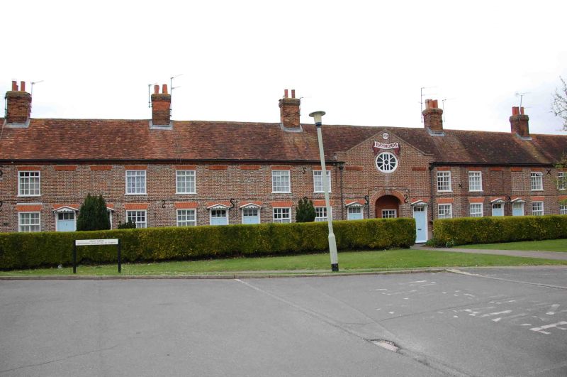
2. 1796 (date scroll on central gable) symmetrical terrace of 12 almshouses. Another range at right angles to this one was destroyed in 1943. Two storeys. One window each with paired entrances. Modern hipped red tile roof, with 6 red brick stacks. Brick with coped gable to slightly projecting centrepiece with lunette in the tympanum; arched gateway now blocked. Recessed sash windows with glazing bars and some modern casements. Doorways with gabled hoods, rectangular fanlights and panelled doors. (Newbury Buildings, Past and Present (1973) 47).
Listing NGR: SU4698266616
External links are from the relevant listing authority and, where applicable, Wikidata. Wikidata IDs may be related buildings as well as this specific building. If you want to add or update a link, you will need to do so by editing the Wikidata entry.


Other nearby listed buildings