Approximate Location Map
Large Map »
Latitude: 50.712 / 50°42'43"N
Longitude: -2.4373 / 2°26'14"W
OS Eastings: 369219
OS Northings: 90355
OS Grid: SY692903
Mapcode National: GBR PY.RMX2
Mapcode Global: FRA 57S6.89D
Plus Code: 9C2VPH67+R3
Entry Name: Pillar Box at Junction with South Street
Listing Date: 8 May 1975
Grade: II
Source: Historic England
Source ID: 1290866
English Heritage Legacy ID: 394373
ID on this website: 101290866
Location: Dorchester, Dorset, DT1
County: Dorset
Civil Parish: Dorchester
Built-Up Area: Dorchester
Traditional County: Dorset
Lieutenancy Area (Ceremonial County): Dorset
Church of England Parish: Dorchester and West Stafford
Church of England Diocese: Salisbury
Tagged with: Pillar box
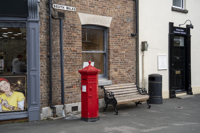
SOUTH WALKS ROAD
1.
5191
(North Side)
Pillar Box at
junction with
South Street
SY 6990 7/298
II
2.
Between 1866 and 1879. Hexagonal "Penfold" type.
Listing NGR: SY6921990355
External links are from the relevant listing authority and, where applicable, Wikidata. Wikidata IDs may be related buildings as well as this specific building. If you want to add or update a link, you will need to do so by editing the Wikidata entry.


Other nearby listed buildings
