Latitude: 51.4009 / 51°24'3"N
Longitude: -1.3241 / 1°19'26"W
OS Eastings: 447116
OS Northings: 167092
OS Grid: SU471670
Mapcode National: GBR 81Z.22T
Mapcode Global: VHCZK.01CW
Plus Code: 9C3WCM2G+99
Entry Name: 149, Bartholomew Street
Listing Date: 8 April 1981
Grade: II
Source: Historic England
Source ID: 1291238
English Heritage Legacy ID: 393766
ID on this website: 101291238
Location: Newbury, West Berkshire, RG14
County: West Berkshire
Civil Parish: Newbury
Built-Up Area: Newbury
Traditional County: Berkshire
Lieutenancy Area (Ceremonial County): Berkshire
Church of England Parish: Newbury St Nicolas
Church of England Diocese: Oxford
Tagged with: Building
1. BARTHOLOMEW STREET 5127 No 149 su 4767 SW 6/43 8.4.81
II GV
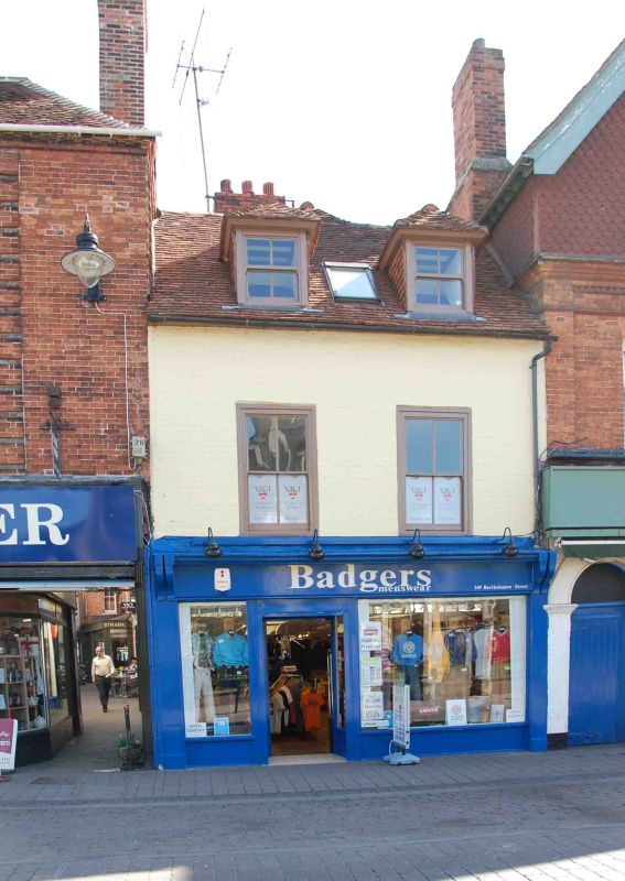
2. Late C18 house, formerly the Cricketer's Arms Inn. Two storeys and dormers. Two windows. Tile roof. Painted brick. Hipped dormer windows. Flush framed sash windows with exposed boxing. Late C19 shopfront.
Listing NGR: SU4711767091
External links are from the relevant listing authority and, where applicable, Wikidata. Wikidata IDs may be related buildings as well as this specific building. If you want to add or update a link, you will need to do so by editing the Wikidata entry.


Other nearby listed buildings