Latitude: 52.903 / 52°54'10"N
Longitude: -2.1482 / 2°8'53"W
OS Eastings: 390125
OS Northings: 333966
OS Grid: SJ901339
Mapcode National: GBR 15J.XB8
Mapcode Global: WHBDD.Z969
Plus Code: 9C4VWV32+6P
Entry Name: Milestone in Front of Number 64 (Not Included)
Listing Date: 27 July 1972
Last Amended: 24 January 1992
Grade: II
Source: Historic England
Source ID: 1291639
English Heritage Legacy ID: 386006
ID on this website: 101291639
Location: Stone, Stafford, Staffordshire, ST15
County: Staffordshire
District: Stafford
Civil Parish: Stone
Built-Up Area: Stone
Traditional County: Staffordshire
Lieutenancy Area (Ceremonial County): Staffordshire
Church of England Parish: Stone Christ Church
Church of England Diocese: Lichfield
Tagged with: Milestone
STONE
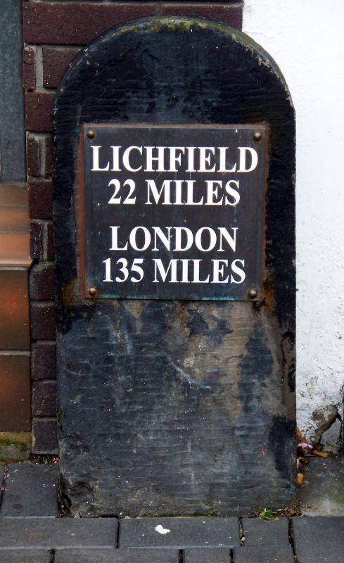
SJ9033 HIGH STREET, Stone 651-1/7/34 (South West side) 27/07/72 Milestone in front of No 64 (not included) (Formerly Listed as: HIGH STREET Milestone (22 miles from Lichfield))
GV II
Milestone. Probably early C19 with late C20 plate. Ashlar with metal plate. Round-headed flat stone post with square plate reading: LICHFIELD/ 22 MILES/ LONDON/ 135 MILES. Stone was an important staging post on the London-Holyhead and London-Carlisle coach routes; the road through Stone was altered in the C19 so that instead of running north west to a left turn at the Crown Hotel (q.v.), it ran further north west to turn into Newcastle Street, therefore this milestone dates from after the change of route. (Stafford Borough Council: Stone Conservation Area: 1987-).
Listing NGR: SJ9012533966
External links are from the relevant listing authority and, where applicable, Wikidata. Wikidata IDs may be related buildings as well as this specific building. If you want to add or update a link, you will need to do so by editing the Wikidata entry.


Other nearby listed buildings