Latitude: 50.3511 / 50°21'3"N
Longitude: -3.5811 / 3°34'51"W
OS Eastings: 287609
OS Northings: 51326
OS Grid: SX876513
Mapcode National: GBR QS.R9LJ
Mapcode Global: FRA 38D3.LP2
Plus Code: 9C2R9C29+CH
Entry Name: 35, Victoria Road
Listing Date: 23 October 1972
Last Amended: 23 February 1994
Grade: II
Source: Historic England
Source ID: 1292086
English Heritage Legacy ID: 387387
ID on this website: 101292086
Location: Dartmouth, South Hams, Devon, TQ6
County: Devon
District: South Hams
Civil Parish: Dartmouth
Built-Up Area: Dartmouth
Traditional County: Devon
Lieutenancy Area (Ceremonial County): Devon
Church of England Parish: Dartmouth Townstal
Church of England Diocese: Exeter
Tagged with: Building
DARTMOUTH
SX874510 VICTORIA ROAD 673-1/8/275 (South side) 23/10/72 No.35 (Formerly Listed as: VICTORIA ROAD (South side) Nos.35-41 (Odd))
GV II
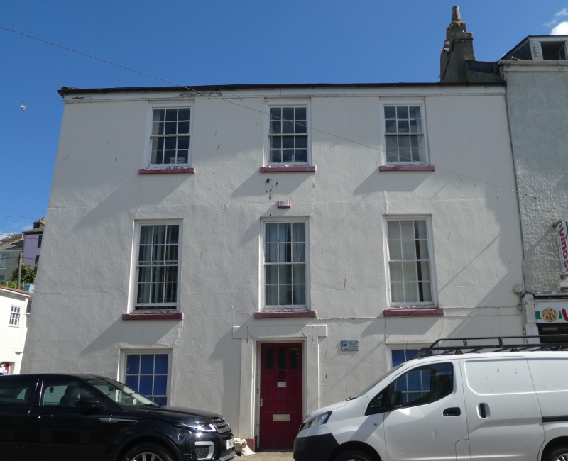
House. Mid C19. Plastered stone rubble; end stacks with rendered chimneyshafts and some old pots; hipped slate roof. PLAN: Double-depth, 2 rooms wide with central entrance hall. EXTERIOR: 3 storeys; symmetrical 3-window front, plastered. Ground floor has central recessed doorway containing original 3/3-panel door under tall overlight with glazing bars. All front windows are horned 12-pane sashes, those on the first floor are taller than the others. Plain eaves and roof hipped to left. 3-window left return, although here windows towards front are blind and onto the stack. To centre, tall and narrow stair window from first to second floors and secondary doorway below. Towards rear, horned 4-pane sashes to lower floors, the bottom one in the middle of a tripartite sash, and second floor has original 12-pane sash. A C19 stone plaque set towards the front is inscribed "Victoria Place". INTERIOR: Not inspected. The house is one of a good group of houses and shops from the second quarter of the C19 alongside New Road (now Victoria Road) which was built in 1825 to enable, for the first time, horse-drawn carriages in and out of the town.
Listing NGR: SX8760951326
External links are from the relevant listing authority and, where applicable, Wikidata. Wikidata IDs may be related buildings as well as this specific building. If you want to add or update a link, you will need to do so by editing the Wikidata entry.


Other nearby listed buildings