Latitude: 50.3512 / 50°21'4"N
Longitude: -3.5804 / 3°34'49"W
OS Eastings: 287656
OS Northings: 51342
OS Grid: SX876513
Mapcode National: GBR QS.R9RY
Mapcode Global: FRA 38D3.LXN
Plus Code: 9C2R9C29+FR
Entry Name: The Windjammer Public House
Listing Date: 23 February 1994
Grade: II
Source: Historic England
Source ID: 1218211
English Heritage Legacy ID: 387385
Also known as: The Windjammer
The Windjammer, Dartmouth
Windjammer
ID on this website: 101218211
Location: Dartmouth, South Hams, Devon, TQ6
County: Devon
District: South Hams
Civil Parish: Dartmouth
Built-Up Area: Dartmouth
Traditional County: Devon
Lieutenancy Area (Ceremonial County): Devon
Church of England Parish: Dartmouth Townstal
Church of England Diocese: Exeter
Tagged with: Pub
DARTMOUTH
SX874510 VICTORIA ROAD 673-1/8/271 (South side) No.23 The Windjammer Public House
GV II
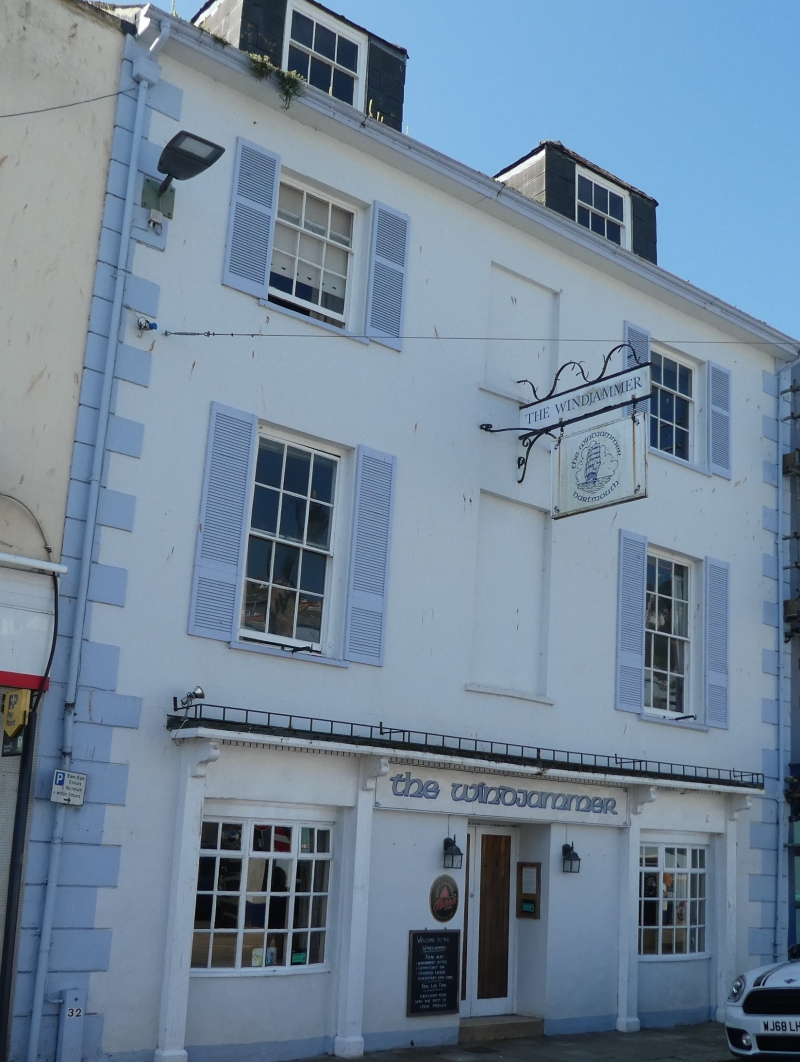
Public house, with house above. c1830. Plastered stone rubble; disused stacks with no chimneyshafts visible; hipped slate roof. PLAN: Double-depth, probably built as a mirror-plan pair of houses. EXTERIOR: 3 storeys; 3-window front, plastered with rusticated quoins each end. Ground floor has C20 pub front with central doorway and flanking windows with glazing bars. Original arrangement above; tall 12-pane sashes to first floor and 3/6-pane sashes to second floor, central blind windows to both floors. Deep eaves with plastered soffit. Parallel roof, taller than its neighbours, with gables each end and includes 2 front dormer windows, slate-hung with hipped roofs containing more 3/6-pane sashes. INTERIOR: Not inspected. Included for group value, the house forms part of an important group of early C19 buildings overlooking the Market Square, which was developed in the 1820s on land reclaimed from the old mill pool. New Road (now Victoria Road) was built in 1825 to enable, for the first time, horse-drawn carriages in and out of the town.
Listing NGR: SX8765651342
External links are from the relevant listing authority and, where applicable, Wikidata. Wikidata IDs may be related buildings as well as this specific building. If you want to add or update a link, you will need to do so by editing the Wikidata entry.


Other nearby listed buildings