Approximate Location Map
Large Map »
Latitude: 51.2942 / 51°17'39"N
Longitude: 0.4079 / 0°24'28"E
OS Eastings: 567978
OS Northings: 157766
OS Grid: TQ679577
Mapcode National: GBR NPC.V7V
Mapcode Global: VHJM5.0QZP
Plus Code: 9F327CV5+M4
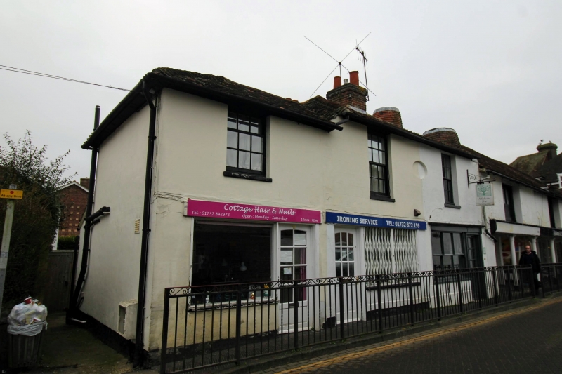
Entry Name: 12, West Street
Listing Date: 30 November 1993
Grade: II
Source: Historic England
Source ID: 1292795
English Heritage Legacy ID: 392485
ID on this website: 101292795
Location: West Malling, Tonbridge and Malling, Kent, ME19
County: Kent
District: Tonbridge and Malling
Civil Parish: West Malling
Built-Up Area: West Malling
Traditional County: Kent
Lieutenancy Area (Ceremonial County): Kent
Church of England Parish: West Malling St Mary
Church of England Diocese: Rochester
Tagged with: Building
WEST MALLING
TQ6757 WEST STREET
1156-0/2/172 (East side)
No.12
GV II
Shop. Early C19. Stuccoed with tiled roof. 2 storeys 1 window.
C20 9-pane sash. Small C20 shopfront and half-glazed door.
Included for group value.
Listing NGR: TQ6797857768
External links are from the relevant listing authority and, where applicable, Wikidata. Wikidata IDs may be related buildings as well as this specific building. If you want to add or update a link, you will need to do so by editing the Wikidata entry.


Other nearby listed buildings
