Latitude: 51.2958 / 51°17'44"N
Longitude: 0.4091 / 0°24'32"E
OS Eastings: 568056
OS Northings: 157942
OS Grid: TQ680579
Mapcode National: GBR NPC.N8B
Mapcode Global: VHJM5.1PMH
Plus Code: 9F327CW5+8J
Entry Name: 2, 4 and 6, King Street
Listing Date: 30 November 1993
Grade: II
Source: Historic England
Source ID: 1292821
English Heritage Legacy ID: 392412
ID on this website: 101292821
Location: West Malling, Tonbridge and Malling, Kent, ME19
County: Kent
District: Tonbridge and Malling
Civil Parish: West Malling
Built-Up Area: West Malling
Traditional County: Kent
Lieutenancy Area (Ceremonial County): Kent
Church of England Parish: West Malling St Mary
Church of England Diocese: Rochester
Tagged with: Building
WEST MALLING
TQ6857 KING STREET 1156-0/3/100 Nos.2, 4, AND 6
GV II
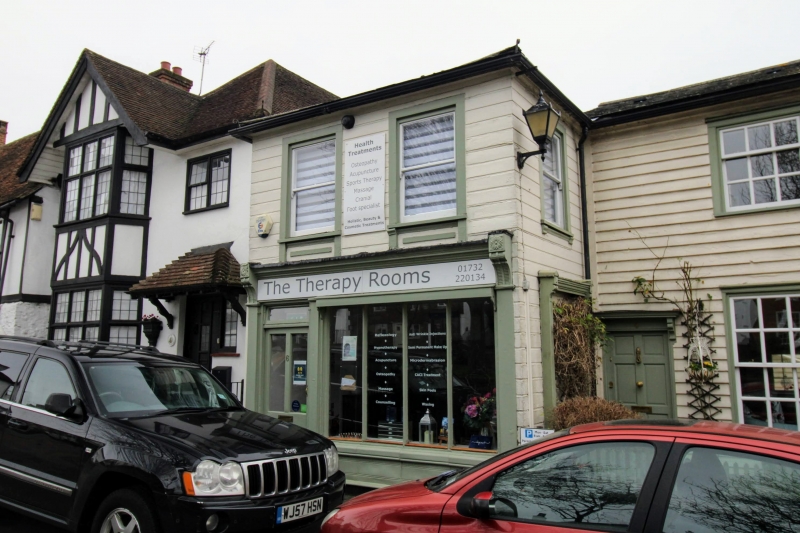
2 cottages and a shop. Nos 2 and 4 c1830, No 6 mid C19. An L-shaped building, weatherboarded (No 6 grooved to imitate masonry) with slate roof, and 1 brick chimneystack. Nos 2 and 4 have 1 window each, C20 top opening sash to 1st floor in moulded architrave. Ground floor has 2 12-pane sashes in moulded architraves. 6-panelled doors either side. with flat hoods on brackets. No 6 projects forward with hipped gable. 2 mid C19 sashes to 1st floor with marginal glazing, horns and unusual carved aprons with brackets. C19 shopfront with 4 divisions. Half-glazed door with rectangular fanlight over and deep fascia. Right-hand side of No 6 has blocked-in C19 shopfront. C20 attached cast-iron lamp bracket in antique style. Rear elevations of No 2 and 4 have sliding sashes. No 6 has projecting C19 weatherboard outbuilding with loading door to 1st floor.
Listing NGR: TQ6805657947
External links are from the relevant listing authority and, where applicable, Wikidata. Wikidata IDs may be related buildings as well as this specific building. If you want to add or update a link, you will need to do so by editing the Wikidata entry.


Other nearby listed buildings